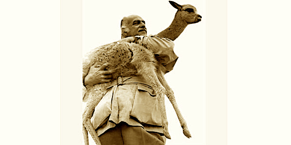
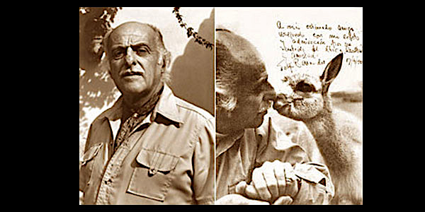
Lacks Heading
-
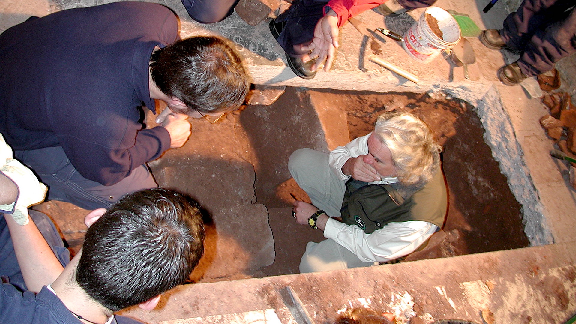 KORICANCHA PROJECTExcavations in the Temple of the Sun of the Incas (Cusco, Peru)
 -
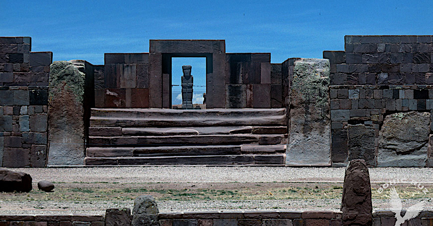
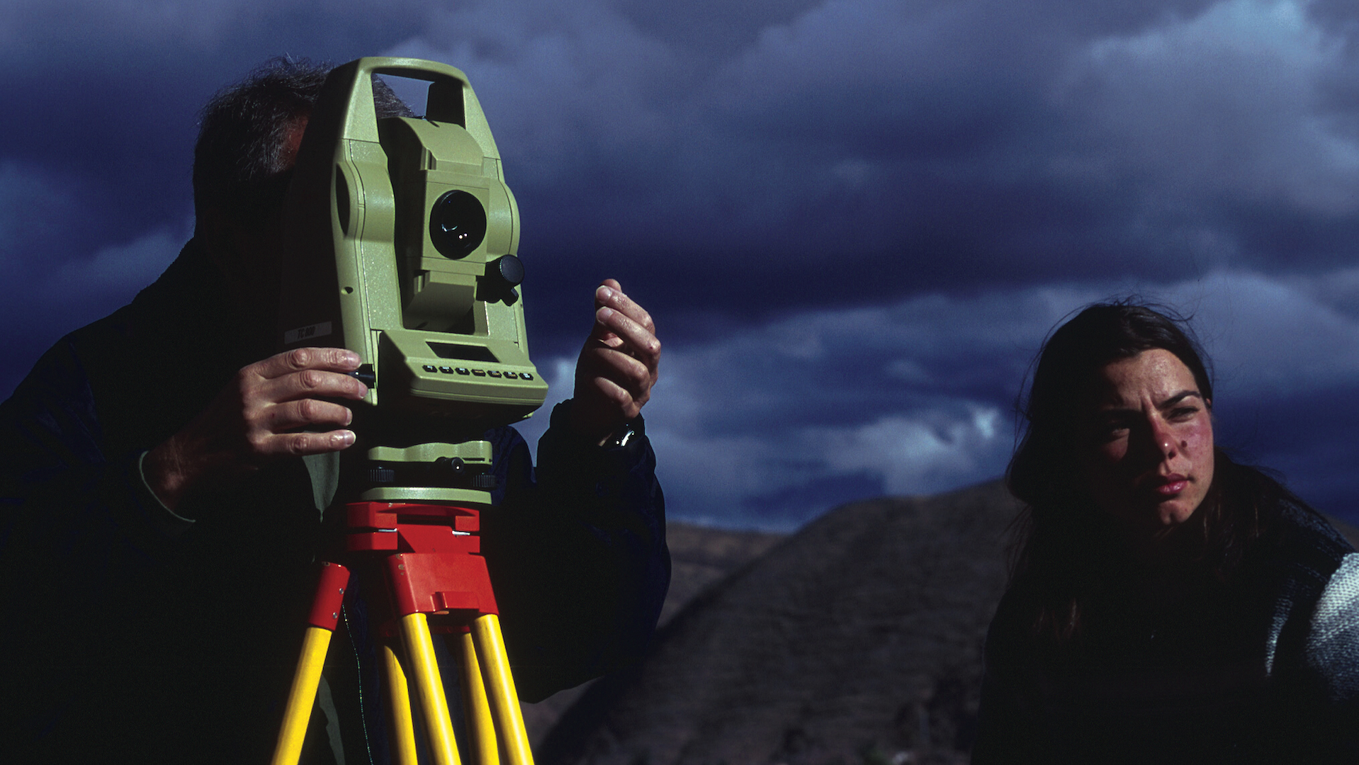
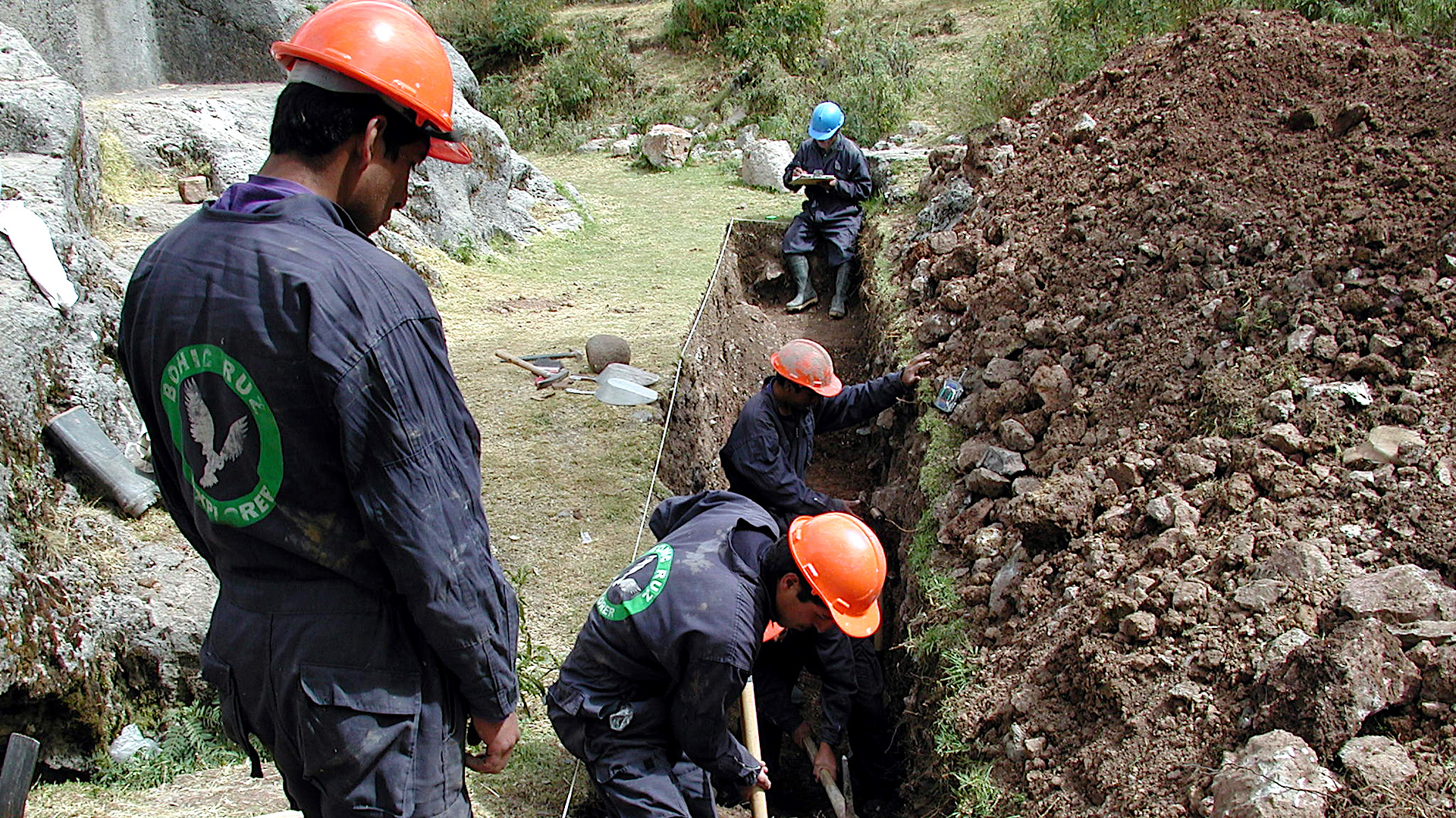 SAQSAYWAMAN PROJECTExcavations in the Chinkana Grande (Cusco, Peru)
 -
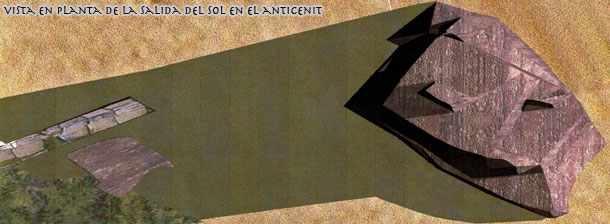
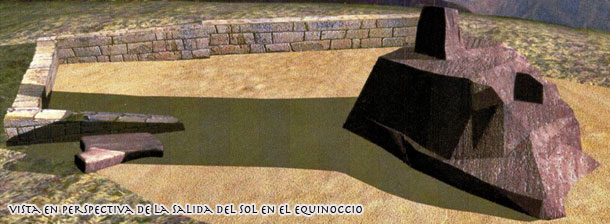
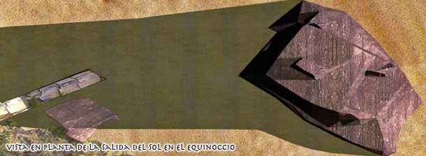
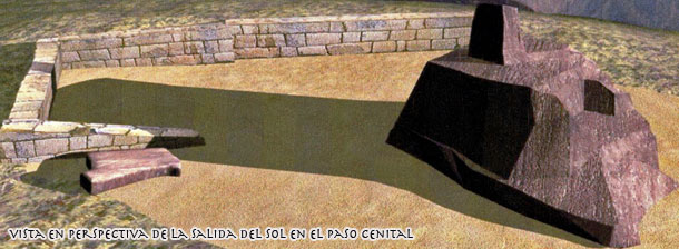
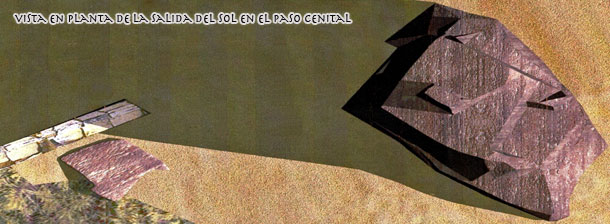
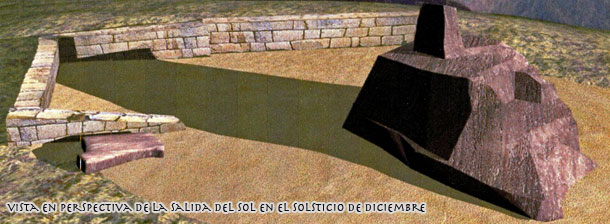
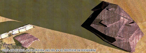
 ARCHAEOASTRONOMICAL WORKSArchaeoastronomical works in the Temple of the Sun of the Incas (Cusco, Peru)
 -
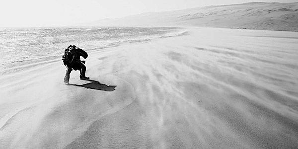
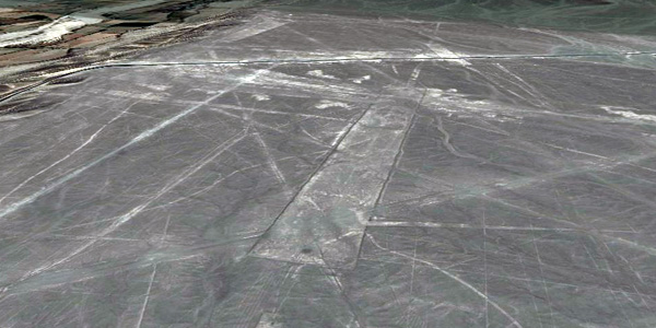
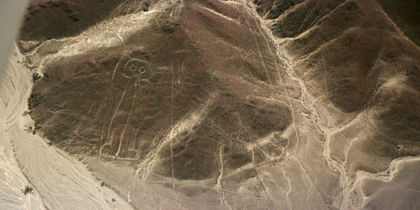
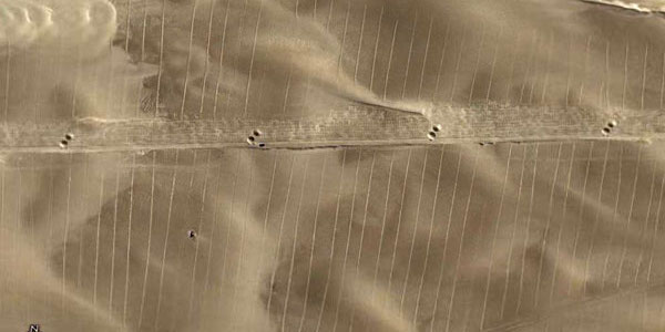
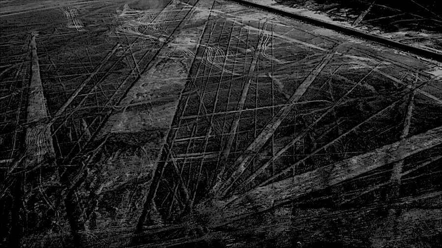
 NAZCA DESERTStudy and filming of the Nazca Lines. Archaeoastronomy and interpretation works (Peru)
 -
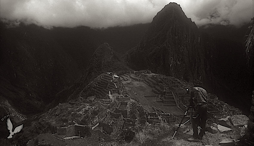
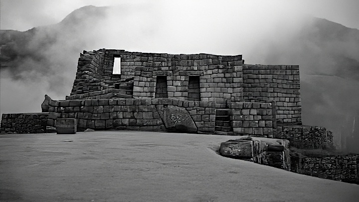
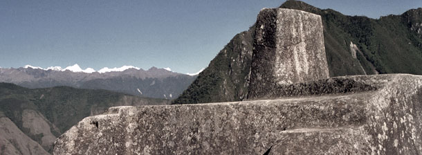
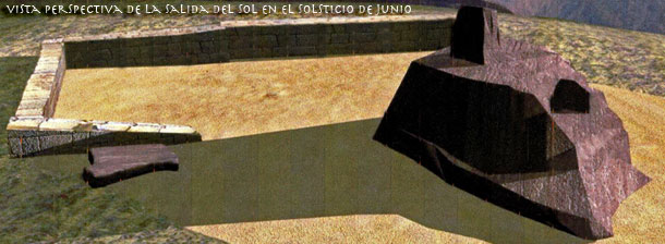
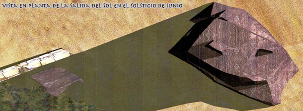
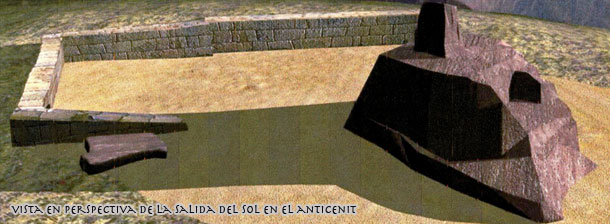
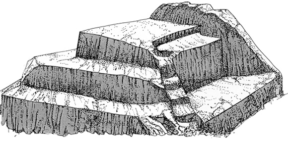
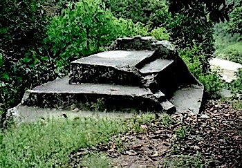
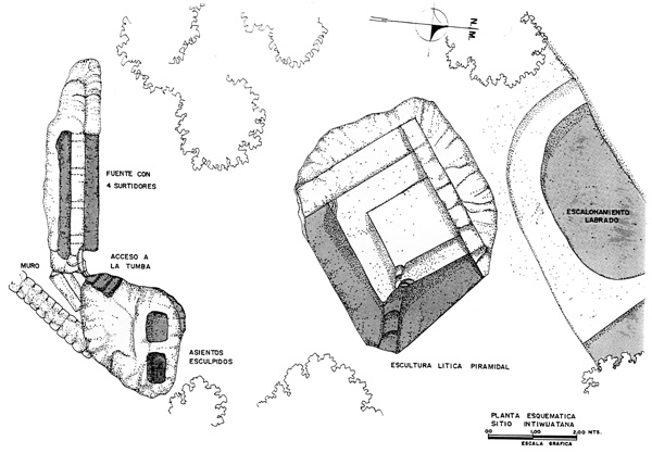
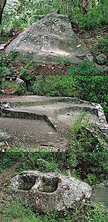
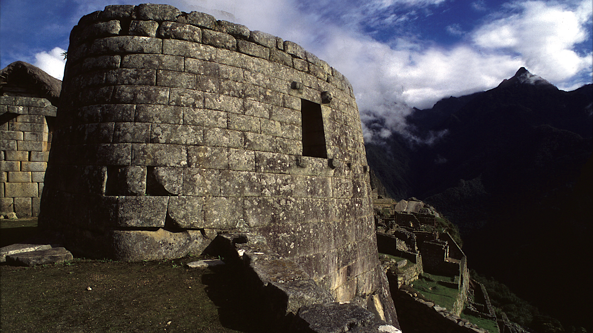 MACHU PICCHUArchaeoastronomy and interpretation work at the Intiwatana
 -
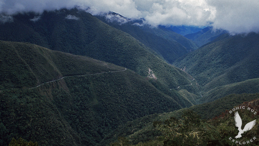
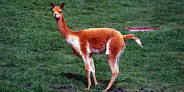
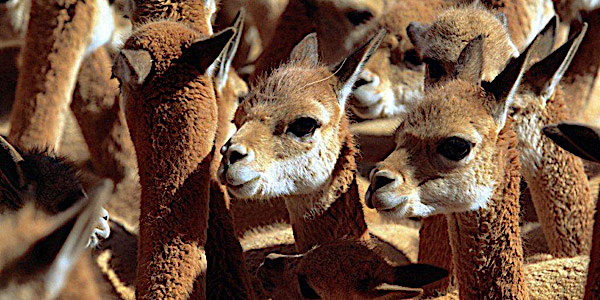
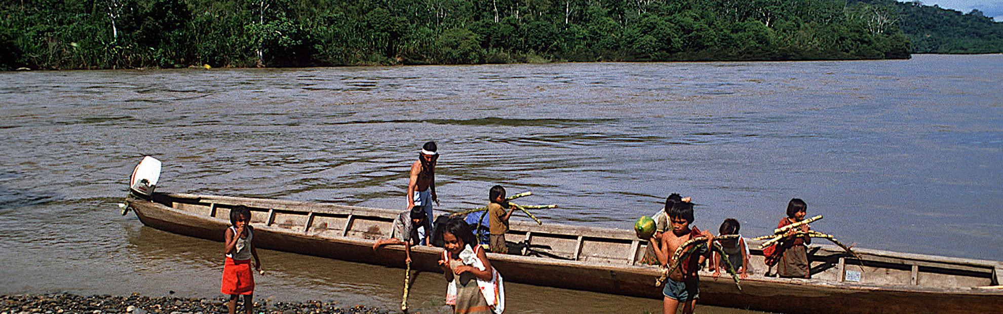 AMAZON JUNGLEEnvironmental impact studies in the Manu Reserve (Peru) with the collaboration of the North American biologist Dra. Jane Stern, professor of Biology at Berkeley (USA)
 -
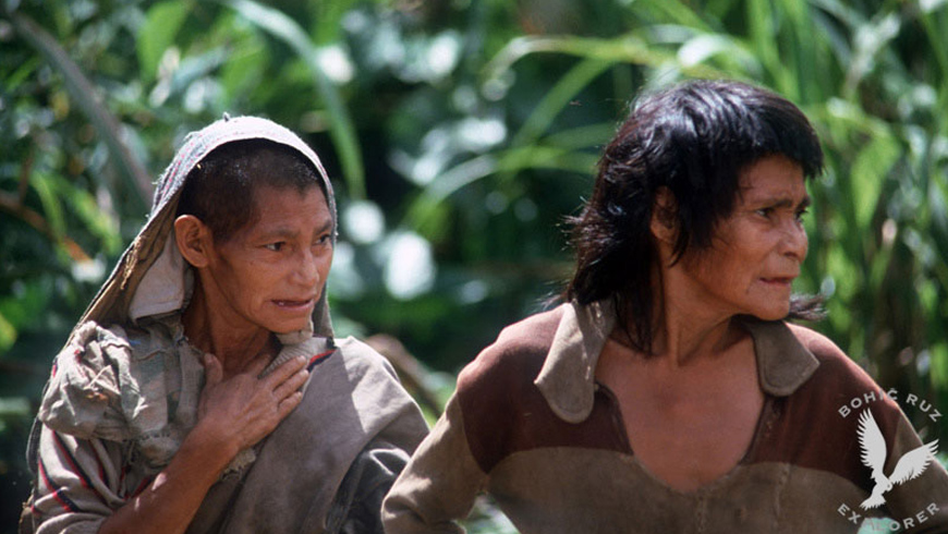
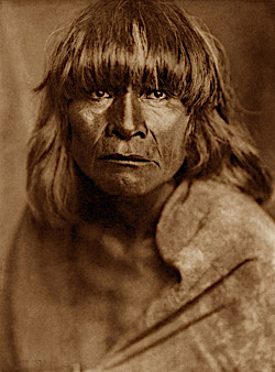
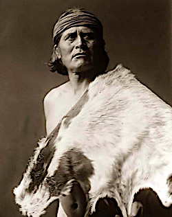
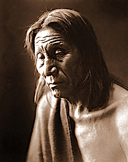
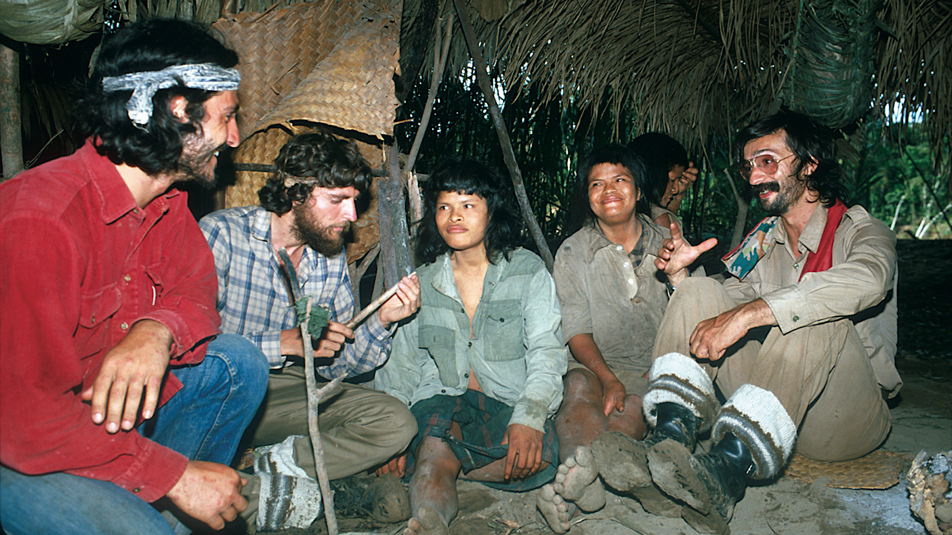 MASHCOPIROSContact and study with an Amazonian tribe in the wild: THE MASHCOPIROS
(Amazon Rainforest, Alto Madre de Dios, Peru) -
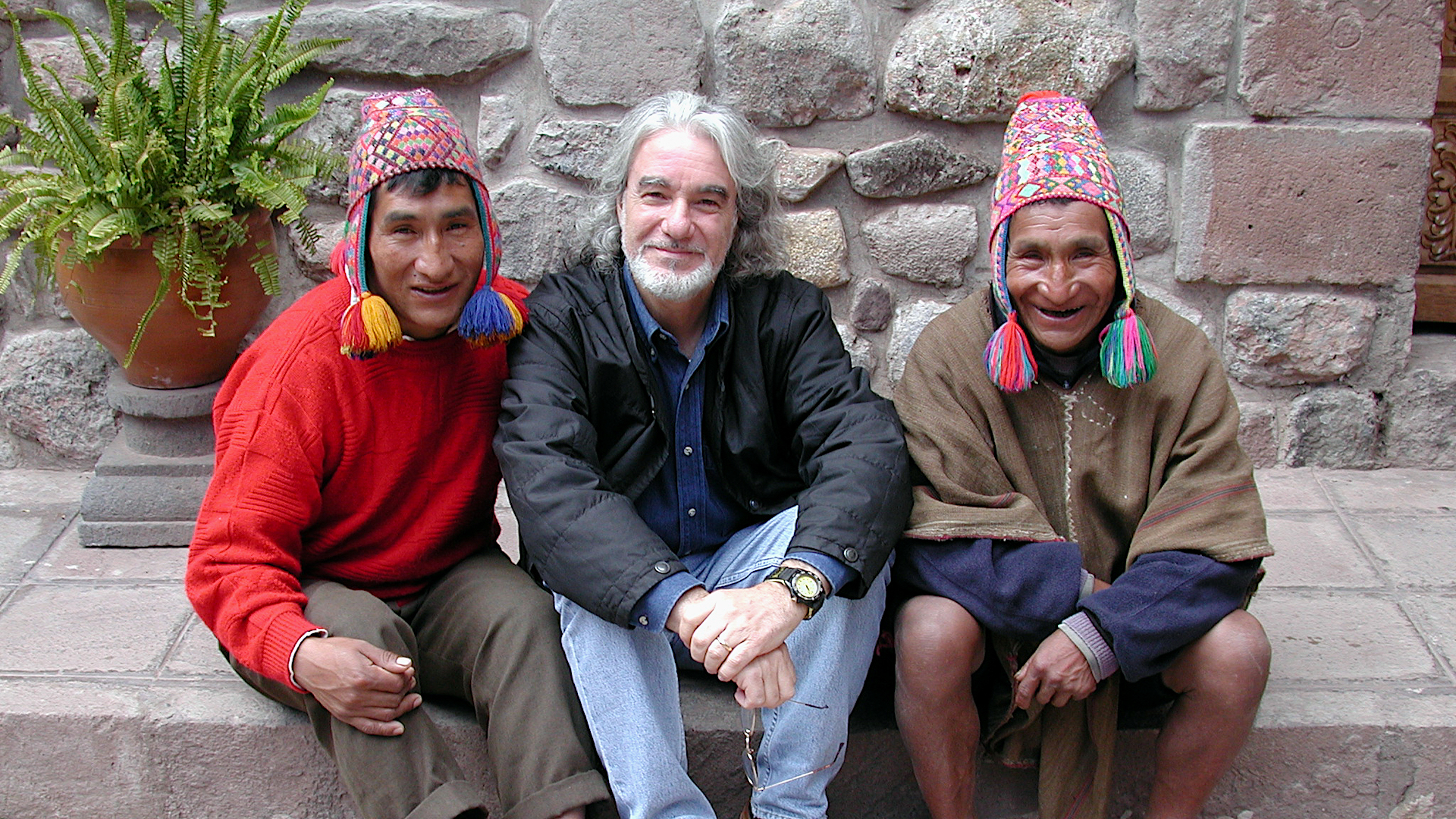 Q'EROS COMMUNITYQ'eros: In Search of the Last Incas
 -
 TIBETAN LAMAISMStudy on Tibetan Lamaism with the spiritual leader, Kalou Kempo Rimpoche, main teacher of the Kagyupa lamaistic line (Sonada Monastery, Darjeeling, India)
PORTFOLIO
OTHER PROJECTS
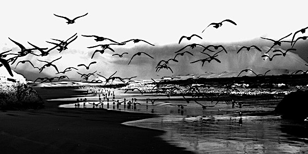
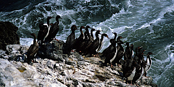
- Migratory Birds (Paracas National Reserve, Peru)
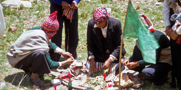
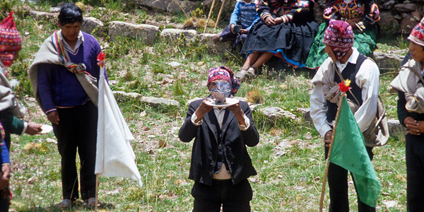
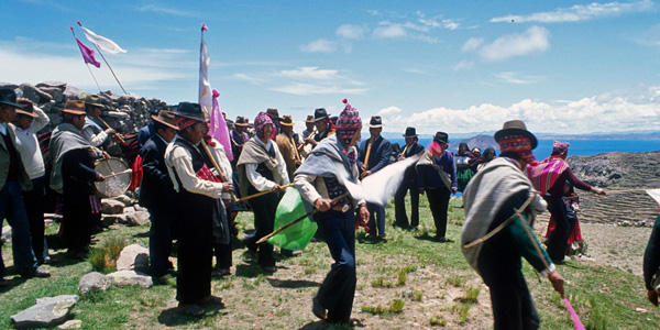
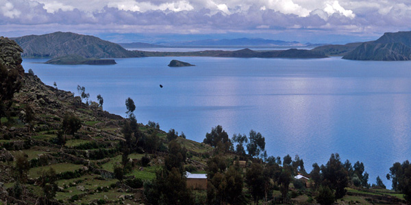
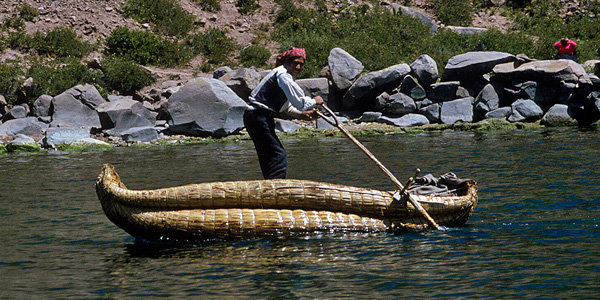
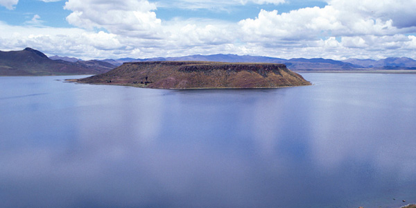
- Ritual Pachamama of the islands Taquile and Amantani (Lake Titicaca, Peru)
- Palenque & Chitzén Itzá, investigation and filming of the ruins (Mexico)
- Pascua Island, Moais study (Chile)
- Atacama Desert, research on petroglyphs and their symbols (Chile)
- Chullpas of Sillustani, investigation and filming of the Chullpas (Titicaca)
- Samaipata, archaeoastronomy studies of the ruins (Bolivia)
- Investigation of the Quero community (Paucartambo, Peru)
- Aguada Blanca National Reserve - photography and filming of the Condor in the Colca Canyon
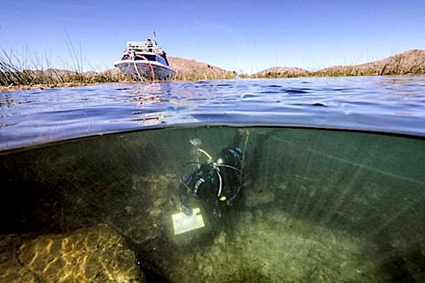
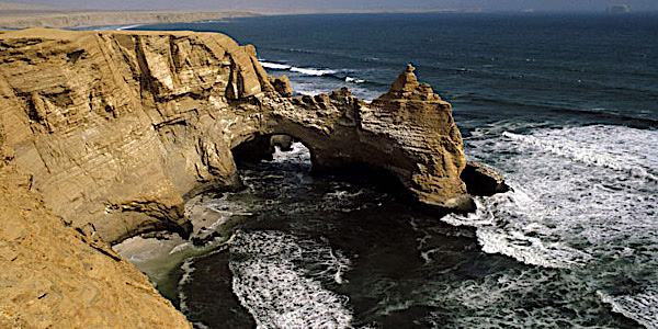
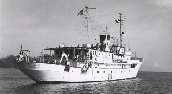
Maritime Exploration
Maritime exploration works on the Peruvian Pacific Ocean coast on the investigation of Asian transpacific voyages in antiquity


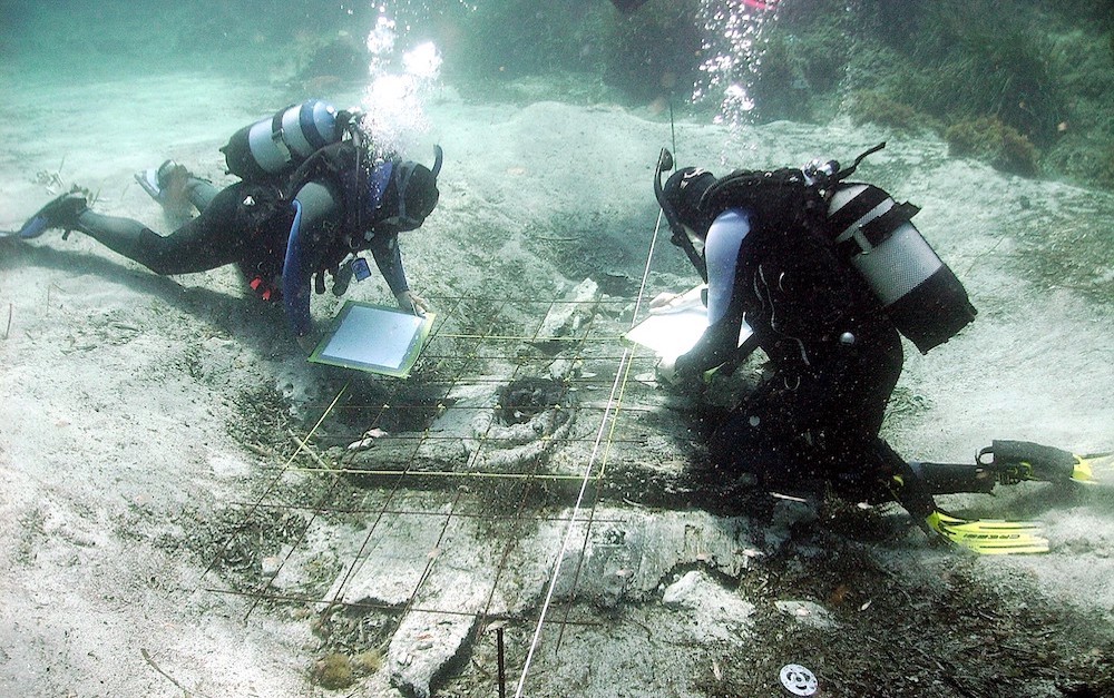
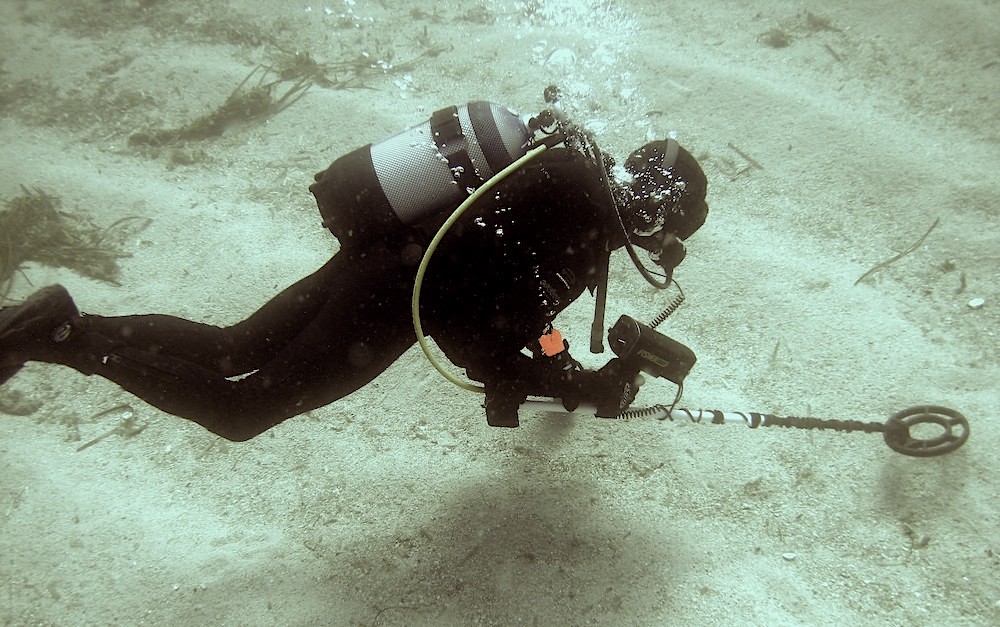
Anselm Pi Rambla and his team will carry out underwater surveys in the Pisco-Paracas area in order to locate archaeological remains of the millenary maritime activity in this important area of the Pacific Ocean.
We have important evidences that this western coast of South America was a maritime zone of important transpacific landings more than 3000 years old.
These investigations are supported by the latest advances in cartography on the ancient works of Ptolemy, Marino de Tiro, Henricus Martellus together with the works of professor Paul Gallez and Dr. Dick Ibarro Grasso.
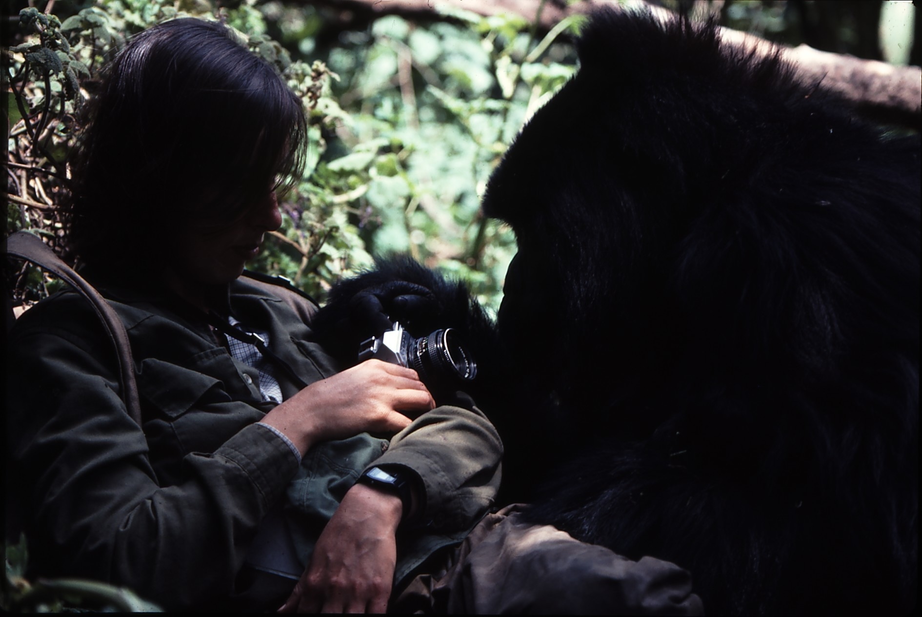
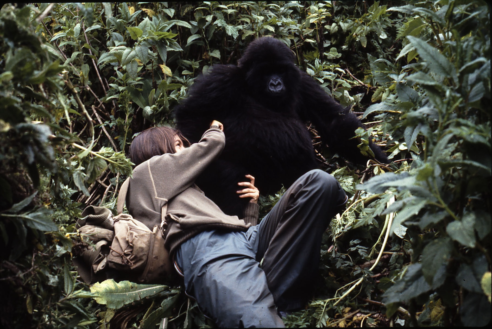
Mountain Gorillas
Research work, carried out by Angela de Dalmau, on the mountain gorilla at the Karisoke Research Center, directed by Dian Fossey
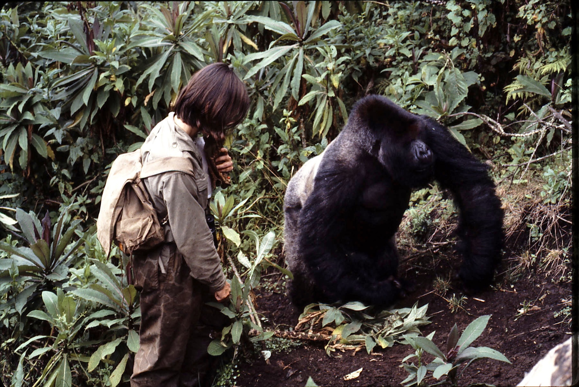
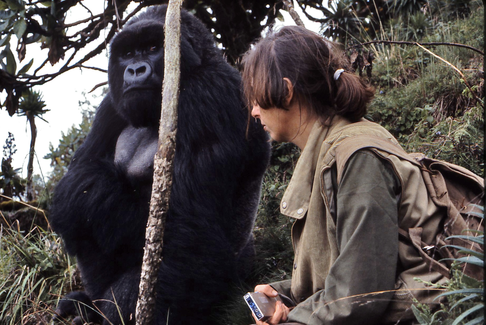
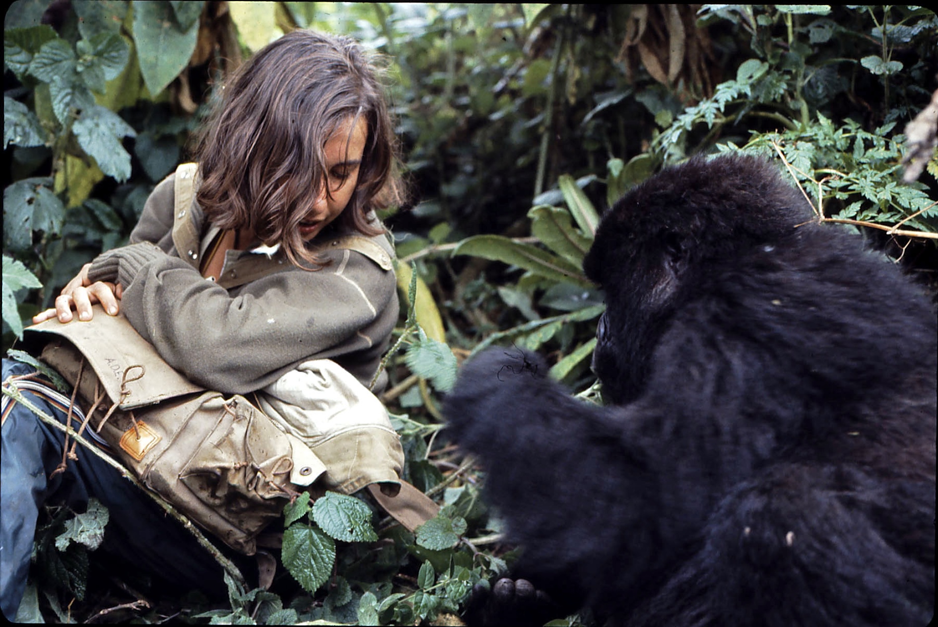
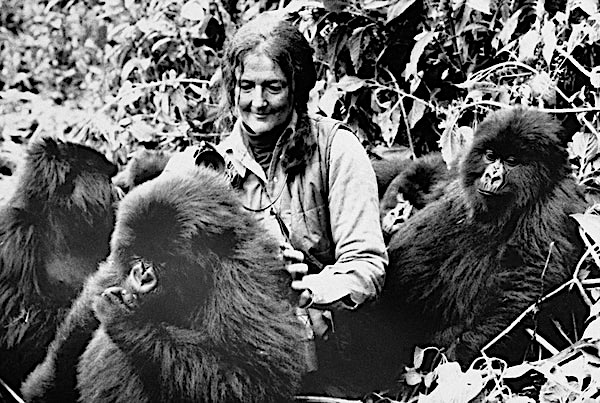
Dian Fossey (January 16, 1932 – December 26, 1985) was an American zoologist. She is best known for studying gorillas in Rwanda.
Fossey was inspired by a book called The Mountain Gorilla by George Schaller. Fossey studied mountain gorillas in Rwanda because of the book. When people want to get close to gorillas and get to know them they have to gain the gorillas trust. Fossey changed her lifestyle to match the gorillas’. She wanted to protect the gorillas from hunters. Hunters were trespassing on a non-hunting ground. She also wanted to protect the endangered animals in the area, even though some people didn’t agree with her ideas. She is a hero to many people for what she did to help mountain gorillas. There is a movie that was made based on what she experienced in Africa. The movie is called Gorillas in the Mist. Her book, also named Gorillas in the Mist, is the best-selling book on gorillas of all time.
She is recognized for saving mountain gorillas and starting a successful fund to help raise money for gorillas everywhere.
Geophysical Research
Archaeological and geophysical works on the Nazca lines
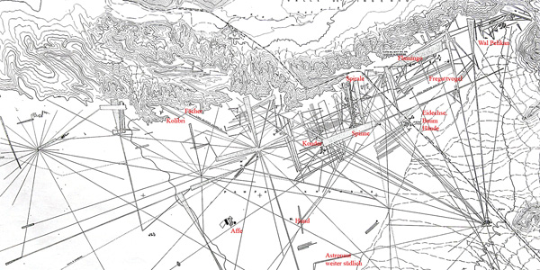
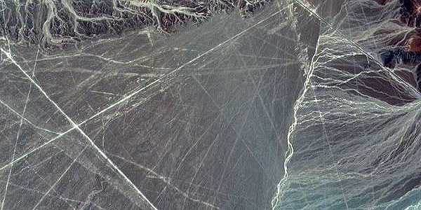

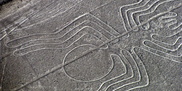
When flying over Nazca, it is enough to observe the immensity of
this desert to where these lines are observable to realize that their whole is chaotic; Some end up
abruptly, others intersect in any direction, some are lost in front of the coast towards the Pacific
Ocean, there are others that are directed towards the Andean mountain range, being impossible to
determine that its design and utility are only astronomical. All of this without forgetting that many
of the lines appear on other older, barely visible, that point to different directions.
We have done many reconnaissance flights in an area from Paracas to beyond Nazca and we have observed
many lines that still today have not been discovered or analyzed by official science.
The scarce rains of this area, one of the driest on the planet, and the lack of obstacles to the wind,
which releases its sand about a hundred kilometers to the north, make the drawings are maintained almost
indefinitely.
Observing this true chaos one realizes that the different interpretations that have been made on Nazca
are far from the reality of what they are and for which they were constructed. We are convinced and
this is where our work points out that it is necessary and essential to combine many more research
disciplines such as studies of history, ancient symbology, geological studies, archaeastronomic and
the latest advances in underground remote sensing systems among others.
Nazca Plate - Atacama Trench Archaeological remains
One of the investigations that we think is most important to consider is why the Nazca Lines are located opposite the critical point of suction in the Atacama Trench due to the push of the Nazca Plate in the Pacific against the South American Plate causing the Andes to rise increasingly.
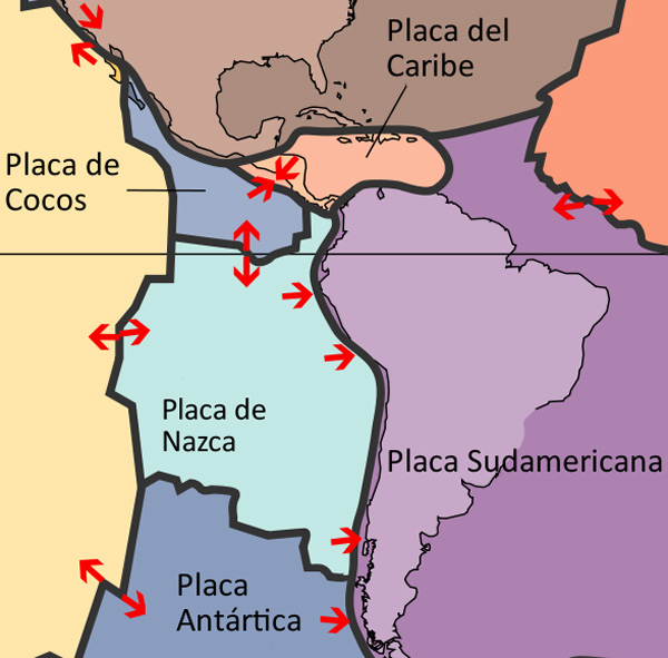
When the earth's crust collapses at one of its inflection points, ancient archaeological remains of the area have been thrown into the ocean abyss. As a notable example of this we can cite the photographs of the "Milne-Edwards" pit taken by Dr. Menzies, of Duke University, from the oceanographic vessel Anton Bruun in 1965, off the coast of Peru.
The sonar recordings made in this area indicated very strange configurations in the ocean floor, which was apparently a muddy surface. The photographs taken at a depth of 2000 meters showed what looked like huge pillars and walls, some covered with calligraphic signs.
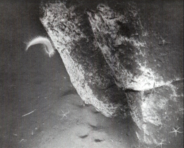
When they tried to take other photographs they noticed that although the position of the special chamber was modified by the submarine currents, other plates of rocks with artificial forms were obtained that lay on the sides, and some of them in piles, as if they had rolled one on top other. This happened at a time when many archaeological remains sank to a depth of more than 1500 meters at the bottom of the sea.
Although this incident shows one of the deepest depths of the ocean in which ruins have been found, it is probable that future underwater explorations, carried out at the same or similar depths, will provide definite evidence, in the relatively near future, of the existence of civilizations Whose remains lie now at the depth of the world's oceans.
Can the Nazca Lines be related to these underwater remains?
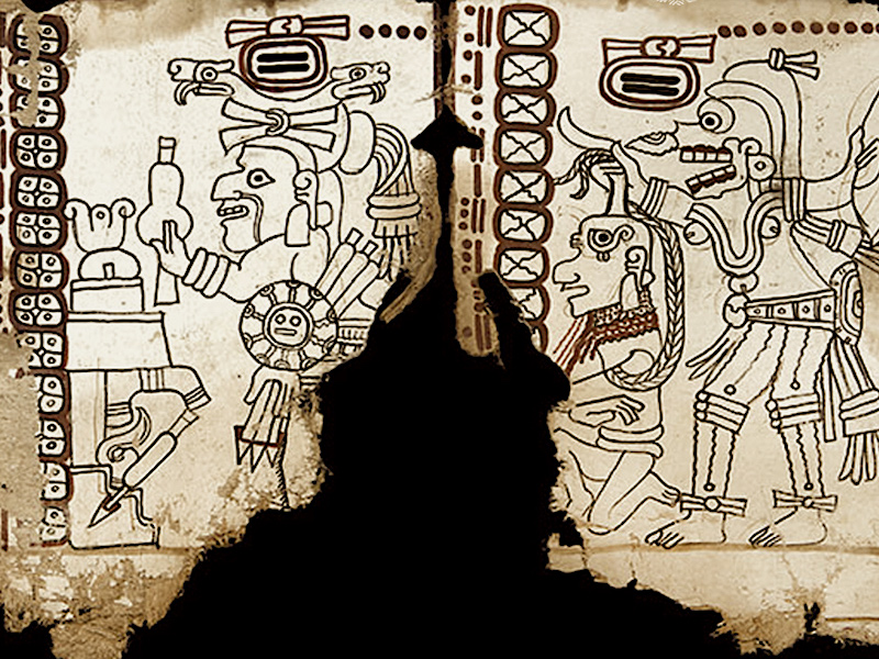
Unknown Maya Codex
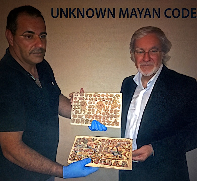
Previously Unknown Mayan Codex Discovered and Authenticated by Period Experts
A few days before the famous end of the Mayan cycle of 5125 years
ending on 12/21/12, a new Maya Codex unknown to date has been presented to the international community.
A research team has discovered an invaluable piece missing from the Mayan culture. The lost codex has
been safeguarded by a family for almost three centuries.
According to experts, this Codex is one of the best preserved of the 4 existing in the world with an
antiquity of (+/-) 1540 AD. It is protected by carved wooden front and rear covers.
In a first analysis they have intervened: Roderick McNeil, Anselm Pi Rambla, McCrone Associates
and Janet G. Smith, ISA.
MAYA CODEX REPORT
IMPORTANCE OF THE NEW MAYAN DISCLOSED CODEX
by Anselm Pi Rambla
The Maya are bearers of one of the most complex and ancient scriptures of Mesoamerica, from very
early times produced an enormous amount of hieroglyphic texts, which they showed a wide variety of
topics.
The texts that have survived from those times are in stone monuments, ceramics and murals, as well as
in their famous "Codex", of which there are three known as authentic: the Dresden, Paris and Madrid,
named after the city where they are currently located.
These three Codex (books of paper, folded and painted on amate bark), developed in the Late Post
classic have been of invaluable importance for the understanding of the Mayan worldview, their system
of counting time and calendrical structure, their religion and their associated gods and rituals, and also
of course to the decryption of their writing, among many other aspects.
We must note that the writing of these Codex have several symbols to represent the same idea, and its
reading is rich in expressions, but highly codified and complex, making it difficult to decode them.
I want to mention that because of this complexity, it has paid little attention to the "mythical"
components in the Codex. An example of this are the numerous references to the date 4 ahaw, 8
Kumk'u, corresponding to August 3114 BC, it’s a purely calendric date used to calculate the
corresponding historical time to the scribes, but that at the same time is a mythological date which
begins the cycle of the Long Count calendar.
This new Codex that has remained unknown to date opens the possibility of understanding much more
these mythical components still un-deciphered, totally necessary components to penetrate the true
knowledge of the Mayan culture. We have a historic invaluable opportunity in deciphering this
unknown "Codex" which undoubtedly will provide a broader view of this important civilization.
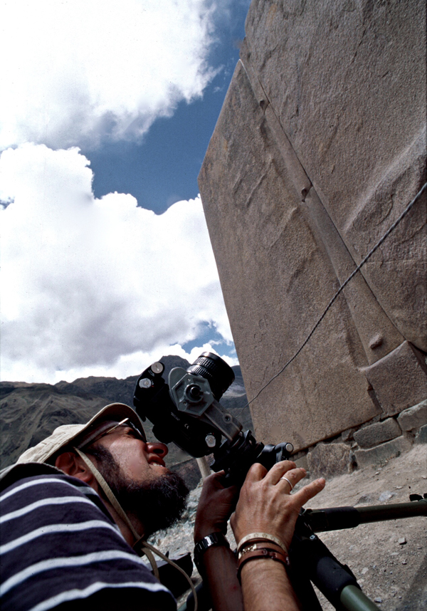
Ollantaytambo
Research and filming works
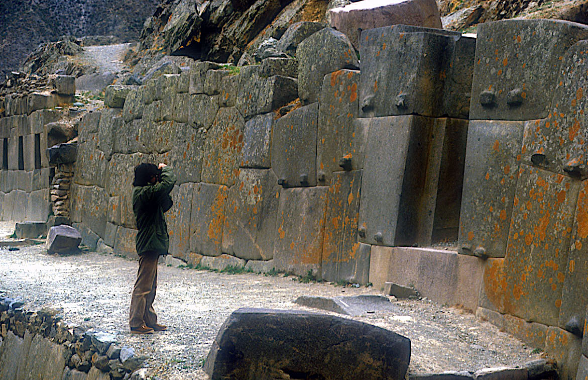
We make films and archaeological and archaeoastronomical research in the ruins of Ollantaytambo, one of the most monumental architectural complexes of the Andes, 80 km. From Cusco in the Urubamba Valley. Commonly called "Fortress" because of its huge walls, it was actually a city-bed and a solar temple, strategically located in the famous "Sacred Valley".
The architectural type used, and the quality of each stone, worked individually make Ollantaytambo one of the works of spectacular and remarkable engineering that made the ancient Peruvians, especially in the area of the Temple of the Sun with its gigantic monoliths.
TEMPLE OF THE SUN
According to Pi Rambla, the sector of the Temple of the sun of Ollantaytambo, which is only a wall was not built by the Incas as announces the official archeology (DC 1440) but by an ancient culture that is still unknown. According to their research, some of the granite stones that make up this wall weighing over forty tons were transported from the mountain which is across the river of a distance of 4 kilometers with a height of over 800 meters.
Many questions arise that even conventional science could not explain: How were they transported these enormous blocks of stone from a quarry located 4 kilometers away, perched on mountain slope to the very top where the sun temple is located? How they were planted and put in place?.
By whom they were built these ruins?
It really was the Incas their true builders?
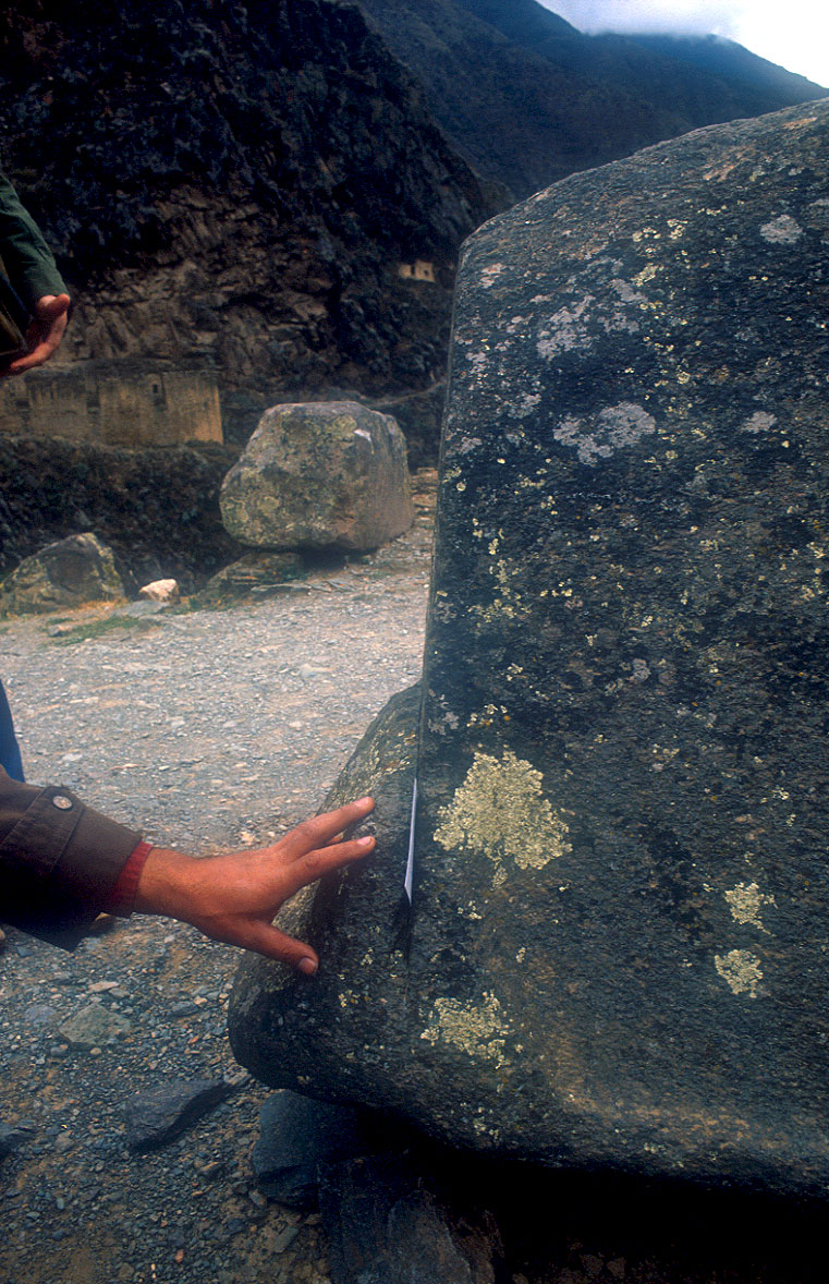
Spectacular rock cut made with a totally unknown and very sophisticated technique as we can see in the photo. How they were cut and polished with such a level of perfection?.
This is not achieved with tools of stone or bronze, as these materials do not make a dent in andesite and pink granite that Ollantaytambo was built. How did you managed to gather each other with such improbable perfection, you can not insert a sheet of paper in the joints? and they did it without any mortar or cement or some kind of sealant.

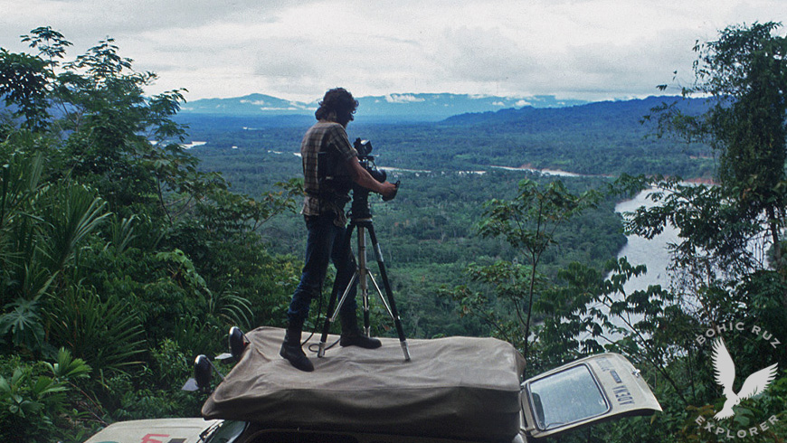
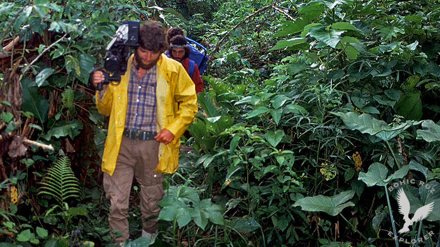
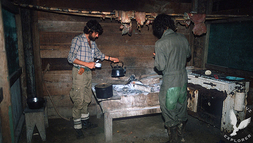
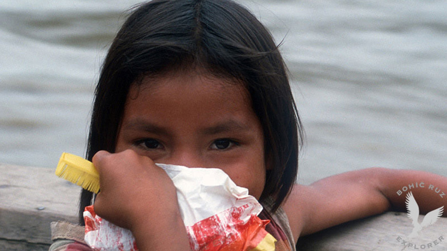
Amazon Jungle Expedition
Mashcopiros uncontacted tribe
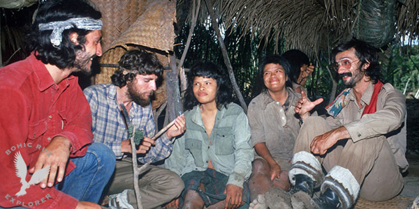
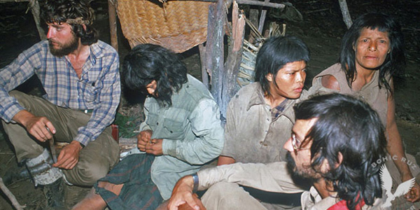
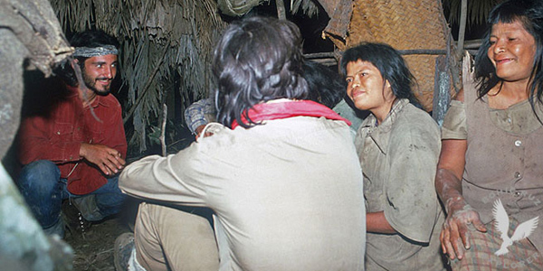
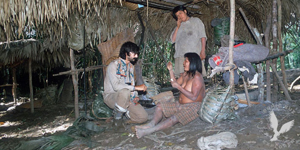
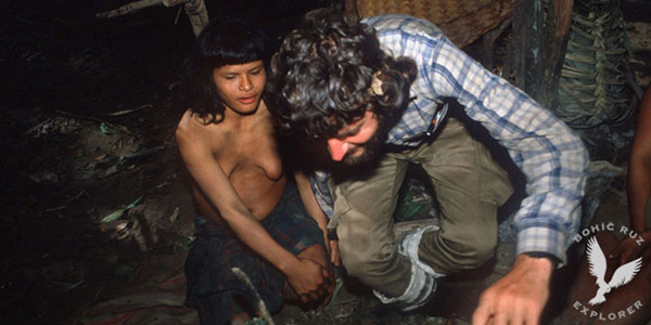
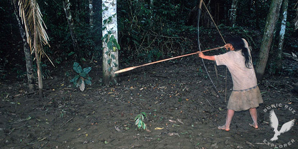
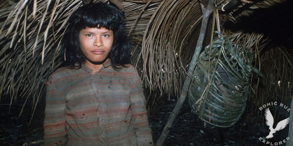

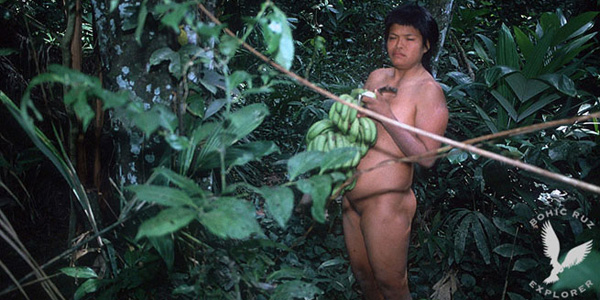
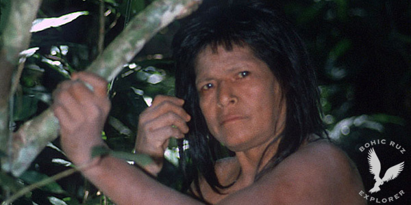
The Pi Rambla Team made a high-risk expedition to Alto Madre de
Dios (Peruvian Amazon Forest) in search of evidence of the existence of the mythical citadel of
PAITITI (The Golden City of the Incas).
This territory of the Amazon rainforest, one of the most inhospitable and unknown of the planet, is
according to many reports the place where the famous citadel is so sought after by many explorers
and adventurers. An area that the same guides do not want to penetrate for fear of reprisals of tribes
very bellicose and not yet contacted.
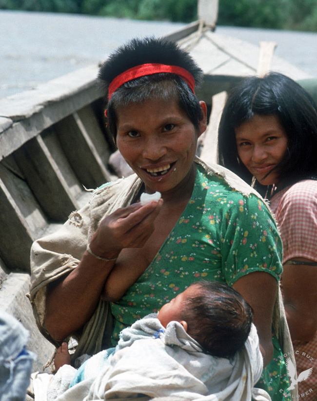
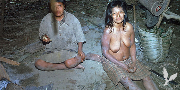
In a very dangerous area of the jungle we were lucky to contact for the first time with 3 women of
the unknown Mashcopiro tribe. A tribe that has never contacted our civilization to date and that no
expedition has ever been so close to them.
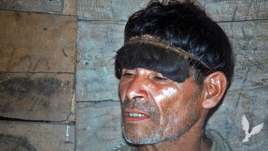
With our native guides Piros and Machiguengas who accompanied us we tried to establish a communication
with the 3 women with great difficulty because they spoke a different and unknown dialect. The data
that we could obtain indicate that, in its territory, there are archaeological ruins of the Inca area
that could be the remains of the famous Paititi mentioned in many ancient traditions.
The place is very difficult to access because it is guarded by native tribes that do not let any
stranger penetrate.
Mashcopiros uncontacted tribe
The three Mashcopiro women spoke a dialect totally unknown
and were displaced about 10 kilometers from their camp, apparently expelled and marginalized by
their own tribe.
Our native guides did not dare to go further from that place, since we had been attacked by very
bellicose Indians. It is believed that in this area there are approximately 5000 Indians of
different ethnicities not yet contacted: "Yaminahuas, Amahuacas and Mashcopiros among others".
first contact with the Mashcopirian tribe (NEVER contacted by our civilization)
The Hopi Way
Study the Hopi traditions with Dan Evehema Family
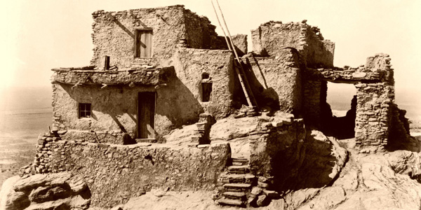
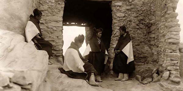
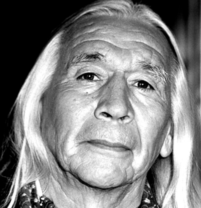
Pi Rambla Team participated in an ethnological research with leaders and relatives of the spiritual Hopi leader Dan Evehema in Hoteville, Arizona
The Hopi Tradition
According to his tradition, the history of mankind is divided into periods they call "worlds",
which are separated by terrible natural disasters: the first world succumbed by the fire, the second by the ice and the third by Water.
We currently live in the fourth world, and in total, mankind must go seven.
Not being verifiable historically the first two worlds, the Hopi tribal memory goes back to the time of the Third World, whose name was Kasskara.
This was the name, in fact, of a vast continent located at the current site of the Pacific Ocean. But Kasskara was not the only inhabited earth.
There was also the "country of the East". And the inhabitants of this country have the same origin as those of Kasskara.
The Katchinas arrived by Air
The people of that country began to expand itself and conquer new lands, attacking Kasskara face of opposition from the latter to be dominated. They did it with very powerful weapons
(and one immediately thinks of the devastating weapons described in ancient Hindu epics and the atomic explosion of Sodom and Gomorrah), impossible to describe. Only the elect, those selected to be saved and survive in the
next world were gathered under the "shield". The enemy shells burst in the air, so that elected placed under the "shield" remained unscathed. Suddenly, the "country of the East" for some unknown reason disappeared under the
waters of the ocean, and gradually began to sink Kasskara.
At this time, the katchinas helped the elect to move to new land. This marked the end of the third world and the beginning of the fourth. We must clarify that, from the first world, humans were in contact with the katchinas,
word that can be translated as "venerable sages." It was visible beings, of human appearance, they were never taken by gods but only as beings of knowledge and potential higher than the human being. They were able to move
through the air at enormous speeds, and land anywhere. Since it was corporeal beings, They needed to travel to this displacements a flying machines, a "flying shields" -as in the Roman chronicles, like in the chronicles of
Charlemagne who received different names.
Today katchinas no longer exist on Earth. The katchinas dances, as well known in America today are represented by men and women as a substitute for existing beings on the old times. The katchinas could sometimes look strange,
whereas they originally katchina used to make dolls for children to get used to his appearance. Today, these dolls are preferably made for tourists and collectors.
The Great Exodus
The population, according to the traditional memory of the Hopi came to the new land in three different ways. Selected to tour, inspect and prepare, they were brought there by air, on board katchinas shields. The great rest of the population had to save the enormous distance aboard boats. And it was made this journey along a string of islands in the northeast, extending to the lands of South America today.
The Touched by Lightning
The new land called Tautoma, which would mean "the touched by lightning." Tautoma was also the name of the first city erected on the banks of a large lake. According to current
knowledge, Tautoma it identifies with Tiahuanaco while corresponds to the Titicaca Lake, in the current border between Peru and Bolivia.
Subsequently, a cataclysm rocked the city, destroying it, that is the reason the population was scattering across the continent. For a long time these men from the Pacific were dealing in groups and clans on both
sub-continents. Some of these clans were in the company of katchinas, who often intervened to help.
The Hopi were part of the group of tribes who migrated northward, and legends recall a period when they crossed a warm jungle, and a period in which they encountered an "ice wall" that prevented them from advancing towards the
north, and forced them to turn back.
The Red City
Long after these migrations there were clans that still retained the ancient doctrines. These clans came together and built a city "of a trascendental importance, which was called the
red city "", which is identified with Palenque in Mexico's Yucatan. In this city it was established school of learning, whose influence can still be detected in some Hopi. The teachers of the school were the katchinas, and
teaching material consisted essentially of four sections:
1. History of the clans
2. The nature, plants and animals
3. Humans, their structure and their physical and mental functions
4. The cosmos and its relationship with the maker
After a period of numerous clashes between the cities established in the Yucatan, the inhabitants left the area and resumed their northward migration. During this turbulent time the katchinas left Earth. The few clans that
have continued to keep alive the ancient knowledge gathered later in Oreibi, being this the reason for the special significance of this place.
Tunnels and underground facilities
After collecting all the information in these traditions on katchinas, we can say the following conclusions about these beings who, without being considered as divinities at any time
and this is important, they are at the cosmic level of a direct interference in the Works with humans: they had physical body, had the appearance of men in many aspects behave like men, but they had very superior knowledge
than humans.
They possessed flying machines, and a mysterious shield rejecting the enemies projectiles at high altitude. They were also able to make children for women without any sexual contact. To this must be added the skills that
humans learned of katchinas, the most important of which was perhaps cutting and transport of huge stone blocks and, and related to that, the construction of tunnels and underground facilities.
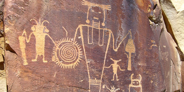
The messengers of the gods
Some of these traditions and findings can corroborate observing the customs of its immediate neighbors, the Zuni and Pueblo Indians, who along with the Hopi are the group of people in
the current Arizona.
For example, the Zuni, whose temples are underground ceremonial chambers, preserved the cult of the plumed serpent as celestial deity, indicating the Mexican origin of certain elements of their religion to link directly to the
image and cult of Quetzalcoatl (identified with Kukulcan and Gucumatz) that it was also feathered and flying serpent, somewhat corroborating the narrations of the Hopi who claim to have established for some time in the area of
Yucatan.
Zuni They also worship the Katchinas for them messengers and intermediaries between the gods of heaven and humans. Thereby practically identified with -messengers of divinity, that in biblical texts operate under the concept
of angels.
Another curious fact is that this group of Indians practice the art of painting in dry sand or pollen, in front of their altars for religious ceremonies. The origin of this art is unknown, and it is also practiced in Tibet and
among some tribes of Australia.
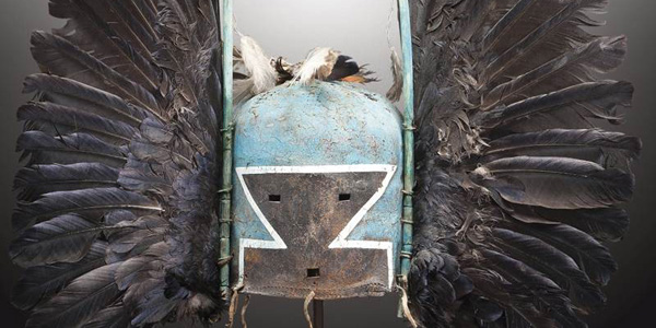
In their reserve of Arizona, the Hopi Indians still maintain the custom of elaborate masks and puppets called katchina or kachina and strictly follow the way of processing and the same "designs" for many centuries.
Hopi message
The modern man sees the old wisdom and ancient knowledge like a dead and useless thing and not respected, only depends on the money system with its extreme consumerism. When food becomes scarce and ecological soil conditions are unbearable, the man attempt to correct the error that caused the earth because of their inventions. You will have to find some method to heal the wound, but this will not be possible when we have reached the point of no return.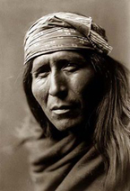
Only peace with the earth and the human being can survive only if the human race we are ready to change this possible. The Hopi play an important role in the survival of human beings
in their vital communication with the unseen forces of nature to maintain balance, as an example of practical alternative to suicide system created by modern man.
The message is simple if a change towards peace does not occur: "The whole world will shake and turn red and will go against those who interfere Mother Earth".