A land that was already on the maps
“Some men embark on the discovery of the New World driven by the incentive of wealth, but God propels them there with a much higher purpose.”Tommaso Campanella · The City of the Sun, 1602
On ancient maps, beyond the eastern end of Asia, an immense peninsula stretches south into the ocean: the Dragon's Tail. For centuries it was thought to be an imaginary land.
The review of the cartography of Marinus of Tyre, Claudius Ptolemy, Al-Khwarizmi and the maps of the 15th and 16th centuries, carried out by leading researchers over the last sixty years, has made it possible for the first time to establish where the Mythical Land mentioned in so many ancient traditions actually lay.
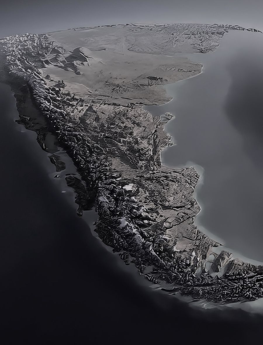
The Dragon's Tail and South America are one and the same land, drawn on maps before Christopher Columbus crossed the Atlantic.
Ptolemy and the Mythical Land
Around the year 150, the Alexandrian geographer Claudius Ptolemy catalogued in his Geographike Hyphegesis some eight thousand places of the known world, with their latitudes and longitudes.
After the Bay of Bengal and the Indochina peninsula, his world map shows a gulf which he called Sinus Magnus, the Great Gulf, followed by a strange land that stretches beyond the Equator. Ptolemy considered it a Mythical Land and closed off the world at about 20° south latitude.
His work, forgotten in the Christian West and preserved in the Arab world, returned to Europe with the Latin translation of 1410. His maps, copied by hand and then printed in Rome (1478) and Ulm (1482 and 1486), guided the Age of Discovery.
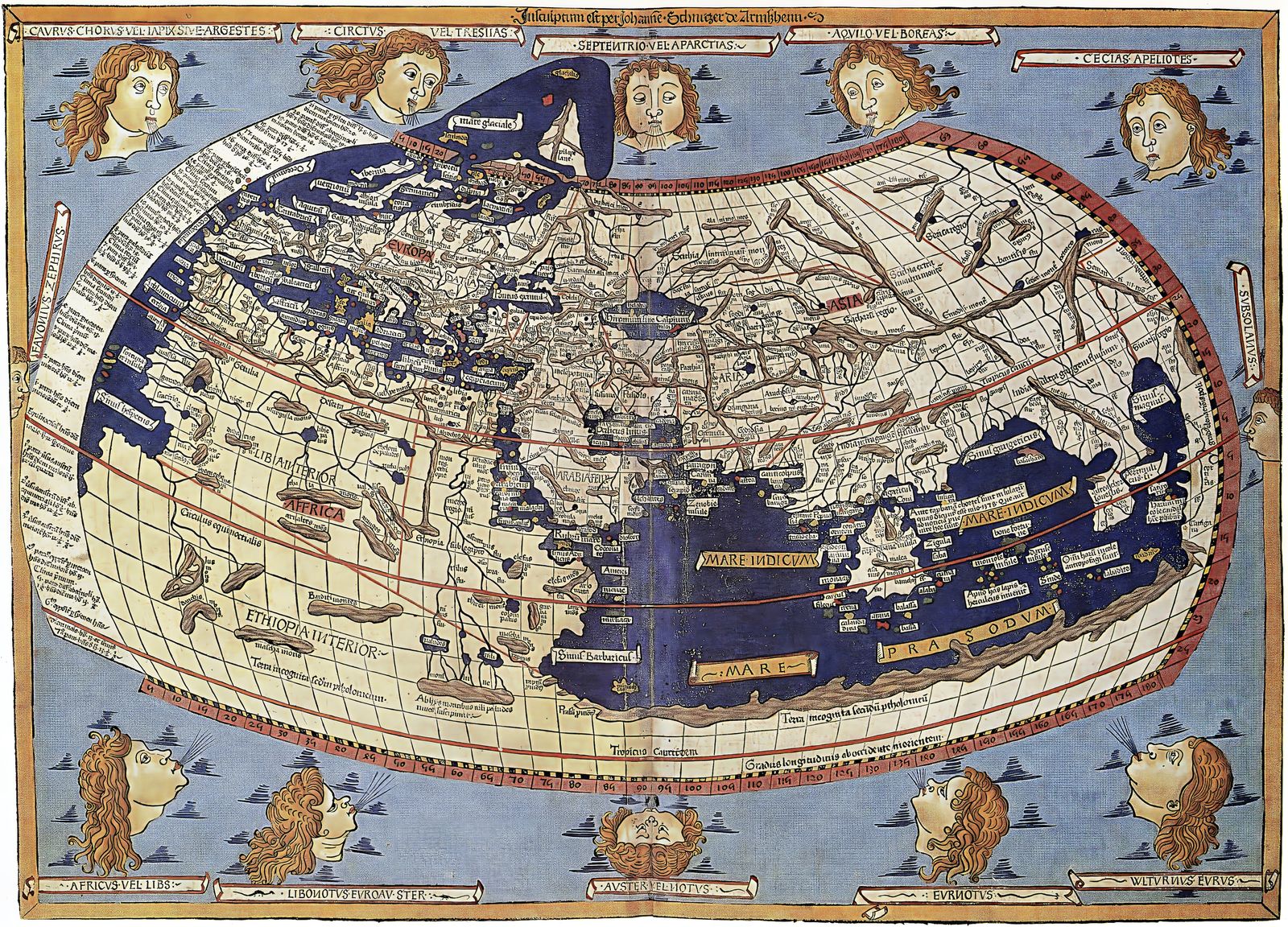
The Argentine anthropologist and historian Dick Edgar Ibarra Grasso undertook an exhaustive study of these maps, published in La representación de América en mapas romanos de tiempos de Cristo. His conclusions, from 1970, were decisive:
- Ptolemy's Great Gulf, the Sinus Magnus, is the Pacific Ocean, the South Sea described by the Spaniards from 1513.
- The profile of the western coast of the Mythical Land matches the western coast of South America.
- On what would be the coast of Peru, a name of Sanskrit root appears: Cattigara.
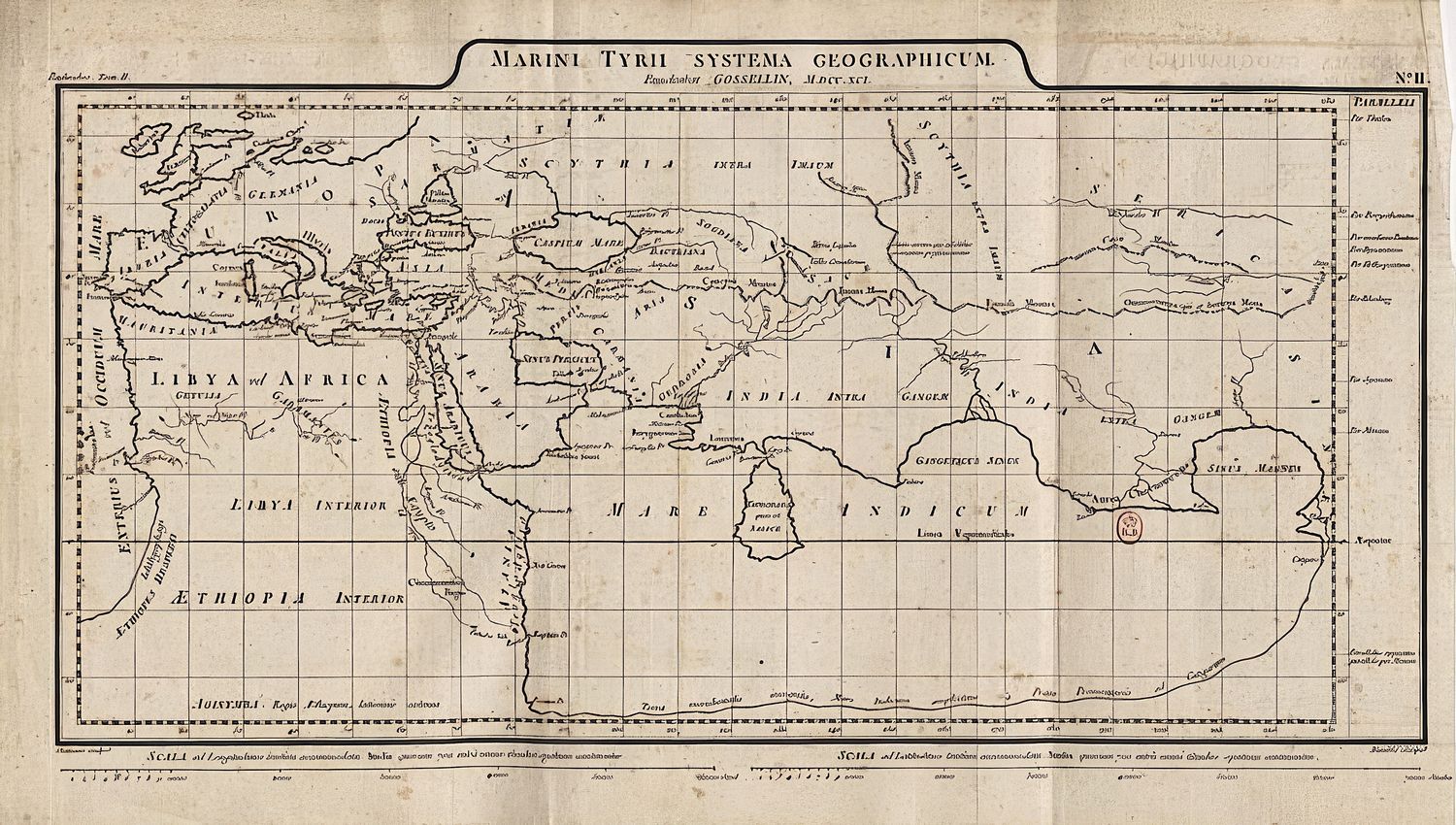
The rivers of Martellus
The Portuguese chronicler Antonio Galvão tells that in 1428 Prince Dom Pedro brought from Italy a world map on which the Strait of Magellan was placed at a spot called the Dragon's Tail. That same Dragon's Tail appears on the world map of Henricus Martellus, dated 1489: three years before Columbus's first voyage.
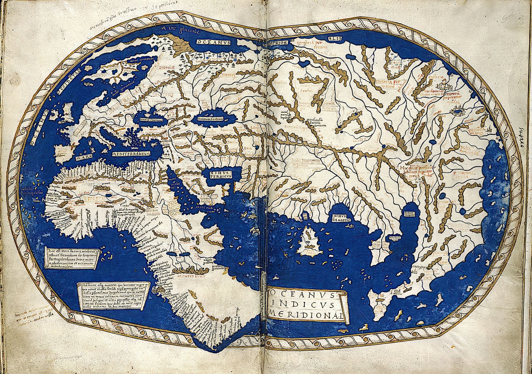
In 1973, the historian Paul Gallez, who lived in Bahía Blanca (Argentina), discovered the entire river network of South America on that map. This is how he told it:
“At three in the morning I got up and went to look at the copy of the Martellus map that I had photographed in London. One by one I identified the rivers: the Magdalena, the Amazon, the Orinoco, the Paraná, the Paraguay, which is surprisingly precise, all with astonishing accuracy… Not one was missing and not one was extra.”Paul Gallez
He published his discovery in the prestigious German journal Erdkunde: “Les grands fleuves d'Amérique du Sud sur le ptolémée londonien de Henri Hammer”.
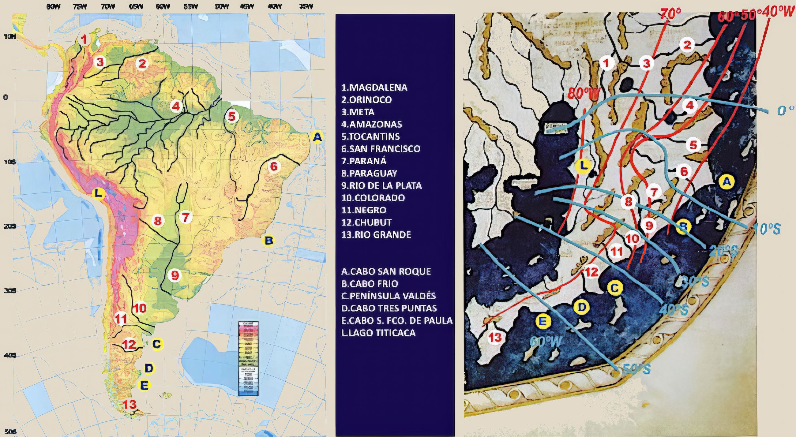
For Gallez, the Paraná-Paraguay system, with its Y shape open to the north-northeast, its lower course turning southeast and its mouth in an estuary, is a pattern unique in the world, and the Martellus map represents it exactly, together with the Serra do Mar. To think that all this is the product of chance in a cartographer's imagination, he concluded, “shows, at the very least, ignorance of the calculation of probabilities”.
Christopher Columbus had excellent maps of South America before setting out on his great explorations.
The southern strait
Martellus drew another world map around 1491, now held by the Beinecke Library at Yale University. In 2018, the historian of cartography Chet Van Duzer published the study of that map using multispectral imaging, which can recover what time had darkened.
Enlarging those images, we found that the only passage between seas on the Dragon's Tail of the 1491 map is precisely the future Strait of Magellan, which separates the continent from Tierra del Fuego. The size and V-shaped orientation of Tierra del Fuego are identical to reality. The strait was known in antiquity, and pre-Columbian navigators sailed beyond 50° south latitude, which implies a circumnavigation in very remote times.
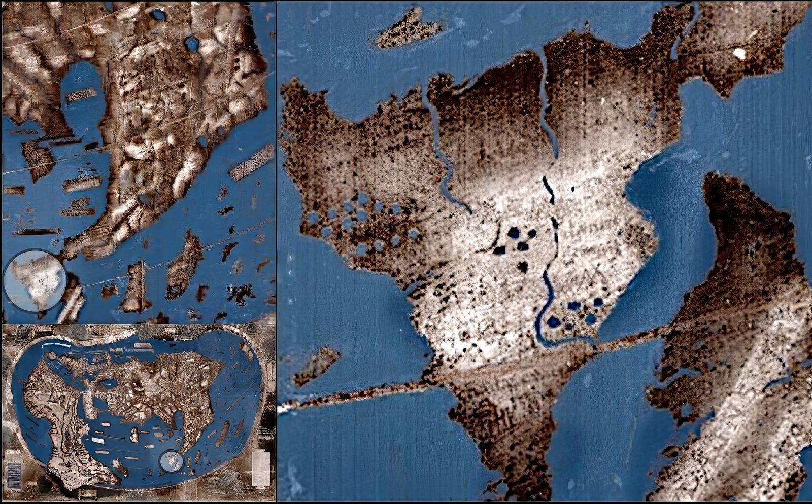
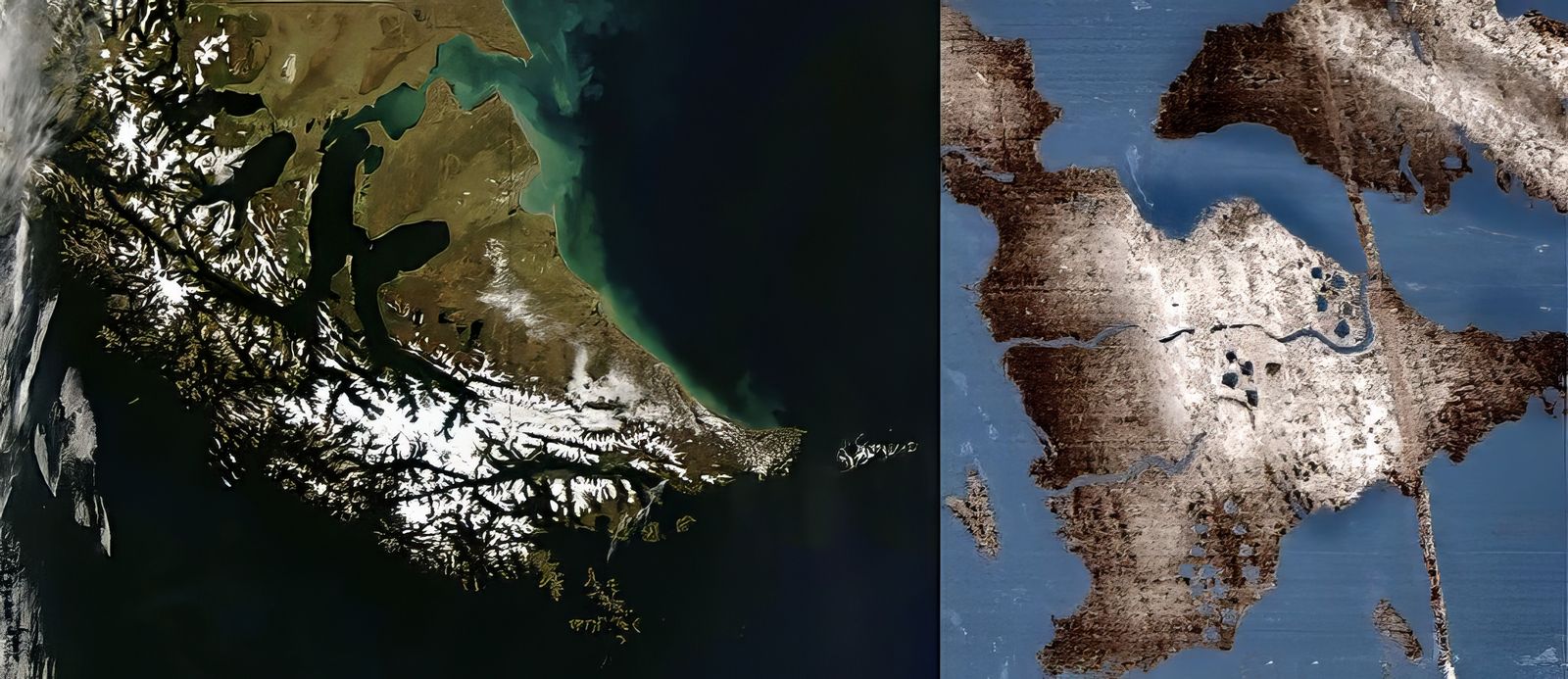
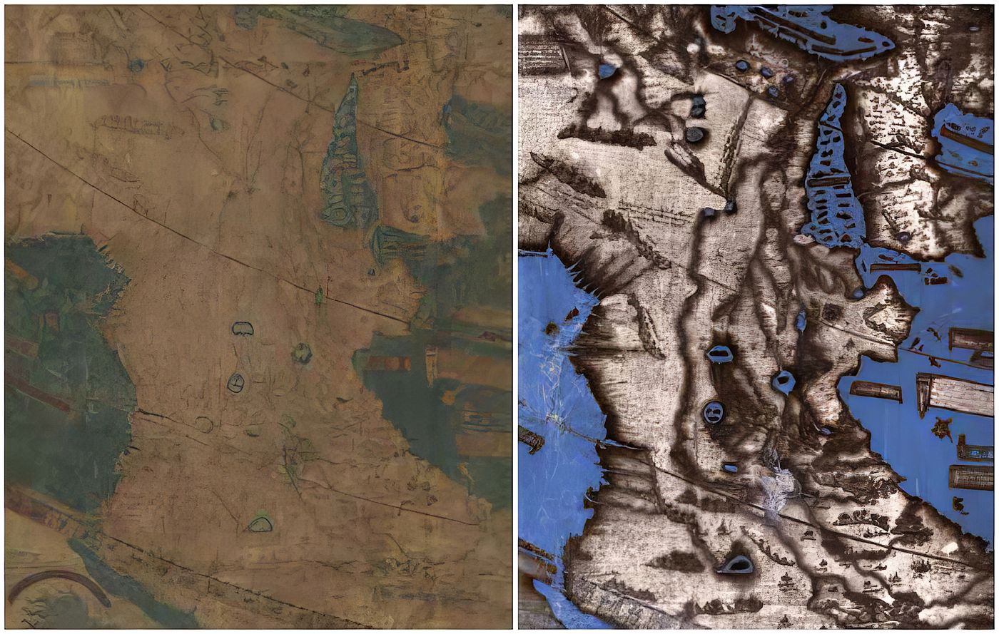
Images: Lazarus Project / MegaVision / RIT / EMEL, courtesy of the Beinecke Library, Yale University.
The Pacific coast
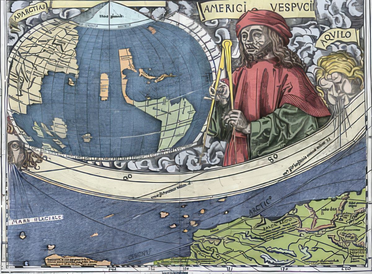
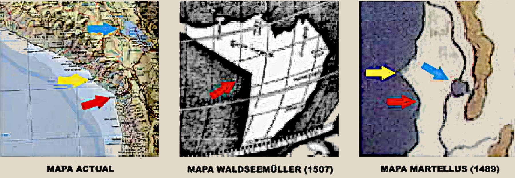
On the map by Martin Waldseemüller of 1507, in the small hemisphere beside Amerigo Vespucci, the angle formed by the South American Pacific coast between Peru and Chile can be clearly seen, in the area of Arica.
That angle cannot be a coincidence: Waldseemüller had data that did not circulate in Europe, necessarily drawn by navigators who explored the American Pacific coast before the Spaniards arrived. Vasco Núñez de Balboa did not reach that ocean until 1513. The 1489 Martellus map already shows Lake Titicaca and the same coastal angle, less pronounced because it uses another projection.
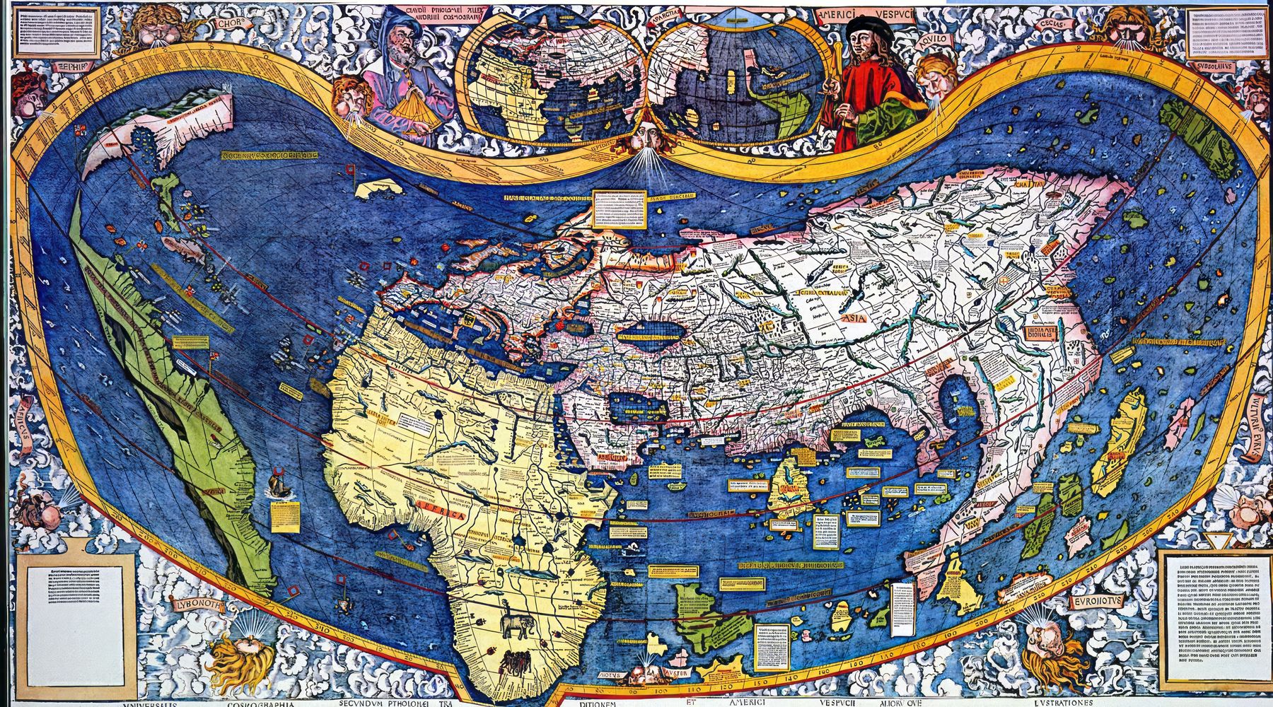
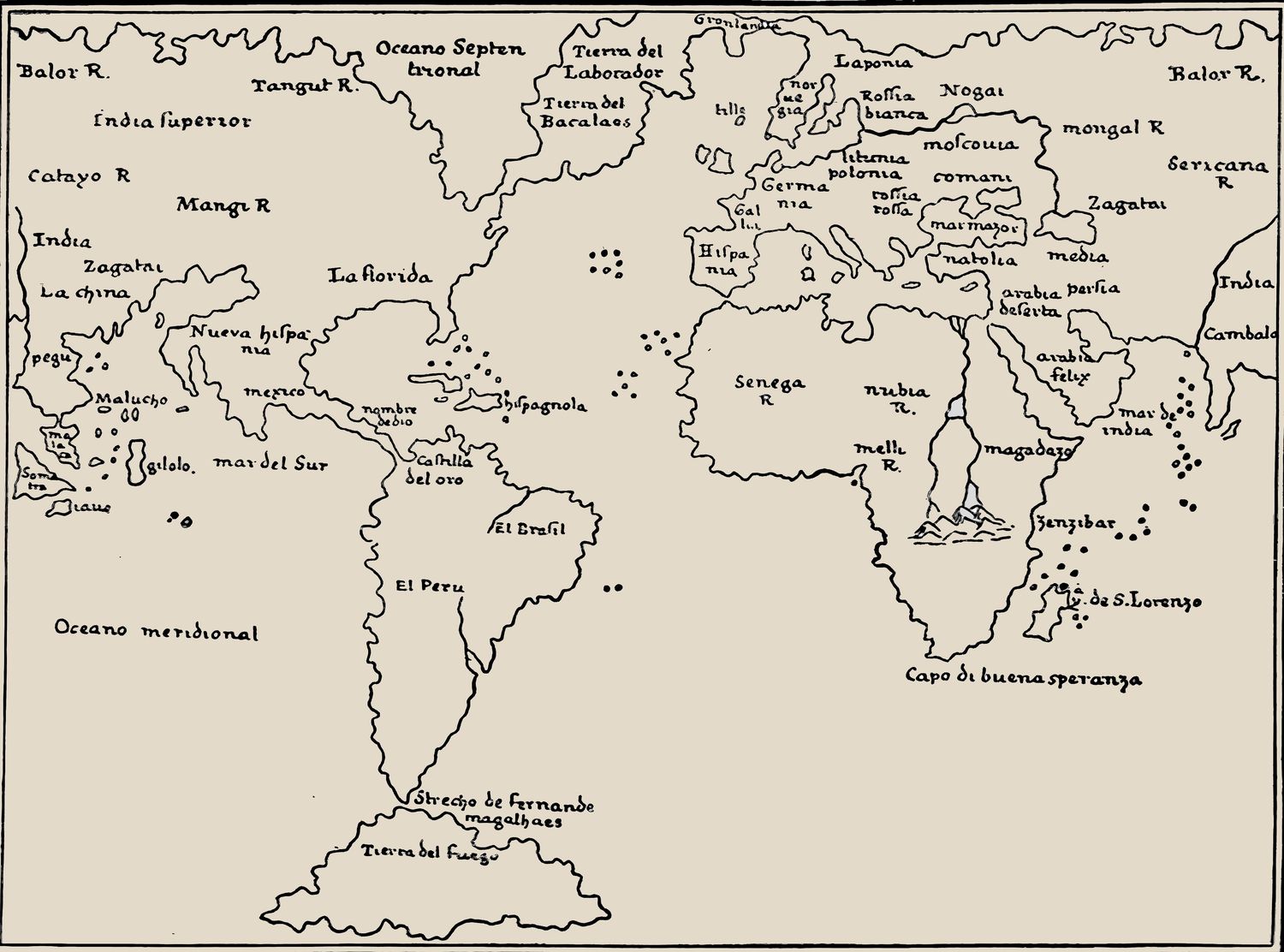
The map by Giacomo Gastaldi (1548) follows the same principles and also shows Tierra del Fuego. South America appears as an immense peninsula joined in the northwest, through the Mesoamerican isthmus, to the Asian continent: to China. And China was traditionally represented by its emblem, the dragon. The great South American peninsula is the Dragon's Tail: hence its name in Ptolemaic cartography.
With the studies of Dick Edgar Ibarra Grasso, Enrique de Gandía, Paul Gallez, Gustavo Vargas Martínez, Jaime Errázuriz Zañartu and Gary Urton, among others, we can now state that South American proto-cartography is the history of the Dragon's Tail on the maps of the 16th century and earlier centuries.
The Earthly Paradise
Medieval world maps placed in the far east, at the antipodes, a mysterious and sacred territory: the Earthly Paradise, source of the four great rivers of creation.
The first complete representation of the Dragon's Tail, with its Pacific and Atlantic coasts, was made by Al-Khwarizmi in the 9th century (year 833). His extraordinary cartographic knowledge presupposes earlier discoveries and sea expeditions: the Dragon's Tail was already known in classical antiquity.
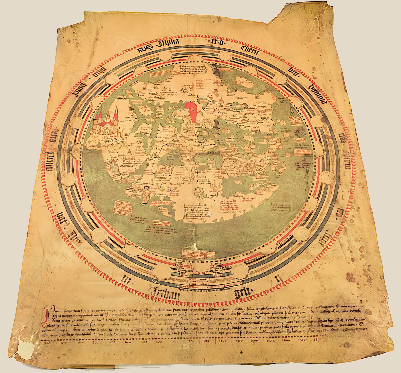
On the world map by Brother Andreas Walsperger (Constance, c. 1448), with south at the top and east to the left, a great peninsula appears which is South America. At its eastern end, a great castle represents the Earthly Paradise with its sacred rivers.
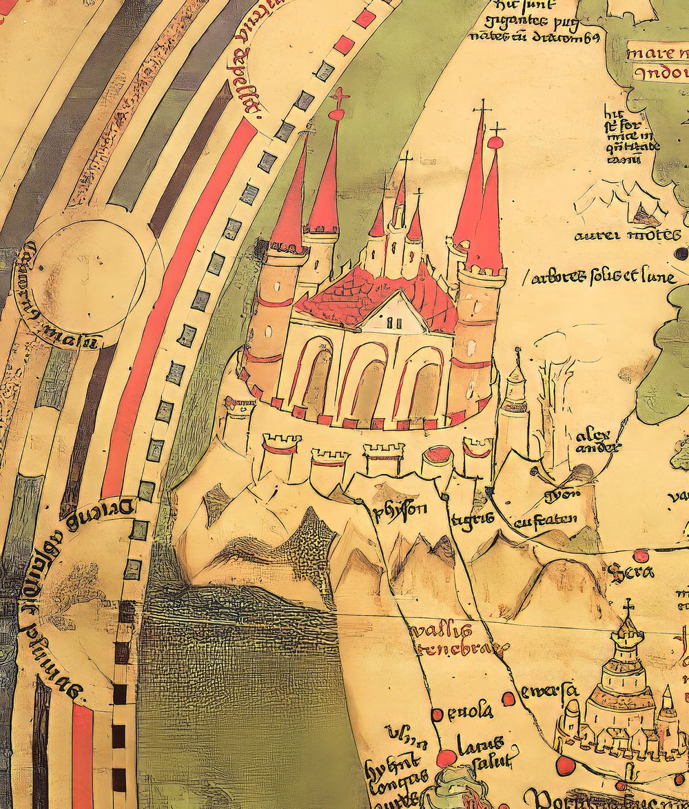
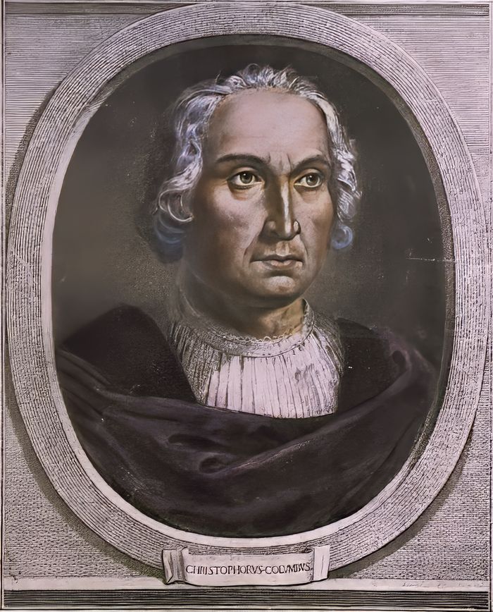
On his third voyage, in 1498, Columbus reached the Gulf of Paria, between the island of Trinidad and Venezuela, near the mouth of the Orinoco, at the passage he named the Dragon's Mouth. He then wrote to the Catholic Monarchs:
“These are great signs of the Earthly Paradise, for the site agrees with the opinion of these holy and sacred theologians.”Christopher Columbus · 1498
Some historians concluded that he was delusional. But Columbus was simply reading his maps correctly, such as Walsperger's, which showed Paradise beyond the mouth of the Orinoco. The most recent research on the maps of Henricus Martellus holds that Columbus used them on his voyages.
The voyages and Cattigara
Our conclusion, after an exhaustive documentary and cartographic analysis, is that the civilizations of pre-Columbian America and those of the Old World were in contact in antiquity, across both the Atlantic and the Pacific Ocean.
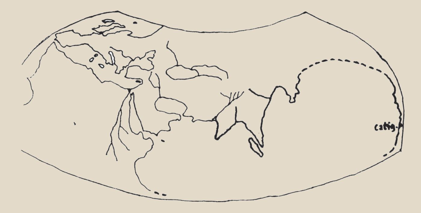
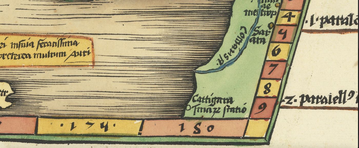
Cattigara was the landing place of the transpacific voyages. Ptolemy calls it Cattigara Hormos Sinon, “the anchorage of the Chinese”. Enrique de Gandía mentions it as Cape Cattigara on a lost world map of 1428, and Amerigo Vespucci and Magellan searched for it.
Given the wealth of clues in ancient cartography, we place it on the coast of Peru, between 8°30' and 15° south latitude. There, the bay of Pisco-Paracas, at 13°50' south, with its calm waters, has always been one of the best havens for navigation.
In our underwater archaeological research in the Paracas reserve we have established that it was a landing area for transpacific voyages more than 3,000 years ago: the very place where the Paracas Candelabra stands.
Cattigara, Tarshish, Ophir and the Earthly Paradise are the cultural substratum of the ancient myths, which come from the Primordial Mother Culture, which the American cultures called the Mythical Land: a land of southern polar origin, named in all pre-Columbian cultures and in ancient texts of the Indo-European cultures.
The Primordial Mother Culture →The research continues. On this page we will publish the new findings in ancient cartography obtained since the book was published.
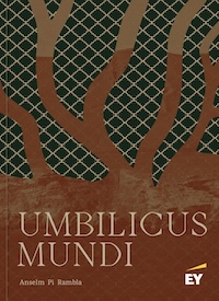
The basis of this research is set out in chapter 2 of Umbilicus Mundi, “Mythical Land. The Dragon's Tail”, by Anselm Pi Rambla.
See Umbilicus Mundi →