Much more than a road
The world knows the Qhapaq Ñan as the great road network of the Tawantinsuyu, a UNESCO World Heritage Site. For us it is much more: a colossal geodesic system, unique on the planet, more than 5,000 years old.
Its design shows a high degree of technological advancement: sophisticated geodesic, astronomical, geographical, geological and architectural knowledge. And its plan was not drawn on the earth, but in the sky.
The Qhapaq Ñan was designed from the constellation of the Southern Cross, and with the Chakana, the sacred measure born from it, the whole network was planned and built.
The Southern Cross
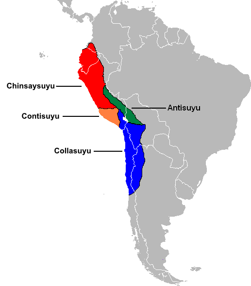
In the Andes, the Southern Cross constellation, with its four stars, was the modulating basis of the territorial organisation known as Tawantinsuyu: the place of the four regions.
Each of the four regions, the suyus, is related to one star of the constellation:
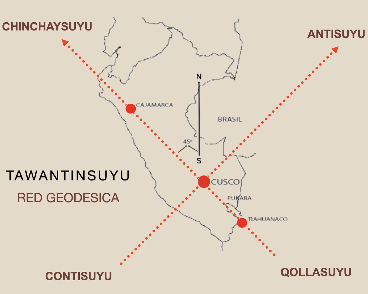
The orientation system is not based on our cardinal points, but on the points between them: in the shape of an X. Two great axes, at 45° from true north (NW/SE and NE/SW), run the length of the mountain range and cross in Cusco, which thus becomes the synthesis of the Tawantinsuyu. Transversal roads joined this main network, linking the highlands, the jungle and the coast.
The Chakana, the Stepped Cross
The great road network of the Qhapaq Ñan was planned and built using the geometric fractal of the Stepped Cross called Chakana (in Quechua, Tawa Chakana: four bridges), derived from the proportions of the Southern Cross constellation.
Its proportional system of measures comes from the relationship between the arms of the constellation: the shorter arm of the Southern Cross is the side of a square, and the longer arm is its diagonal. Its factor of change and variation is the number Pi (π), called Katari in the Andes.

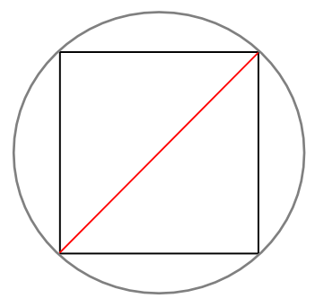
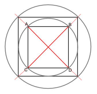
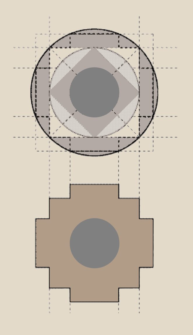
How the Chakana is constructed. Sources: Anselm Pi Rambla; Lajo, 2005.
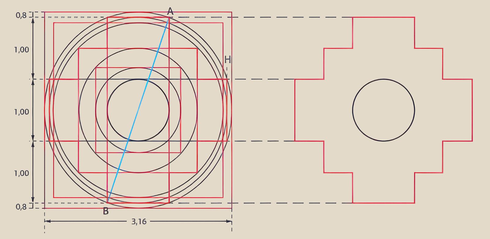
Drawing a Chakana requires measurement patterns and complex modelling schemes related to the Earth and the Cosmos: a knowledge of fractal growth that can only come from a highly advanced scientific, geometric and mathematical development.
Its design comes from a sophisticated process to square the circle and find the relationship between the circumference and its diameter. Its builders obtained the closest approximation to Pi achieved in their time, more than 5,000 years ago.
With this sacred measure, born from the sky, the network of the Qhapaq Ñan was laid out across the Andes.
The Route of Wiracocha
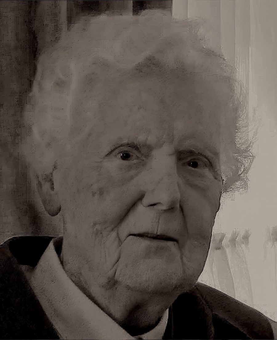
For four hundred years the meaning of this great network was slowly forgotten, until the arrival in Peru, in the 1950s, of the Dutch anthropologist María Scholten de D'Ebneth.
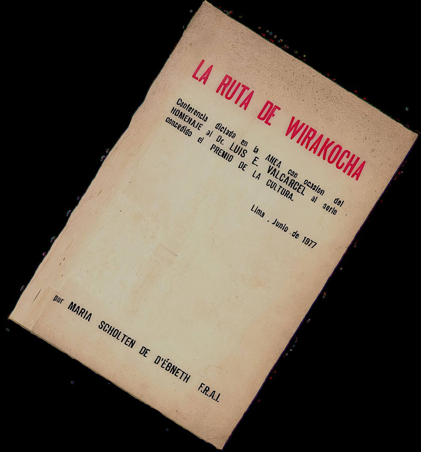
With the help of her husband, the Hungarian sculptor Lajos D'Ebneth, she discovered a unit of measurement which she called the American Unit (A.U.), equivalent to 3.34 in our metric system and its multiples (3.34 × 10ⁿ). She applied it to the Aztec Calendar, to Chavín de Huántar, to the Nazca Lines and to the Andean road system. In 1954 she published Geometría y geografía humana en Sudamérica, and in 1977, after her research in Tiahuanaco and Cusco, La Ruta de Wirakocha.
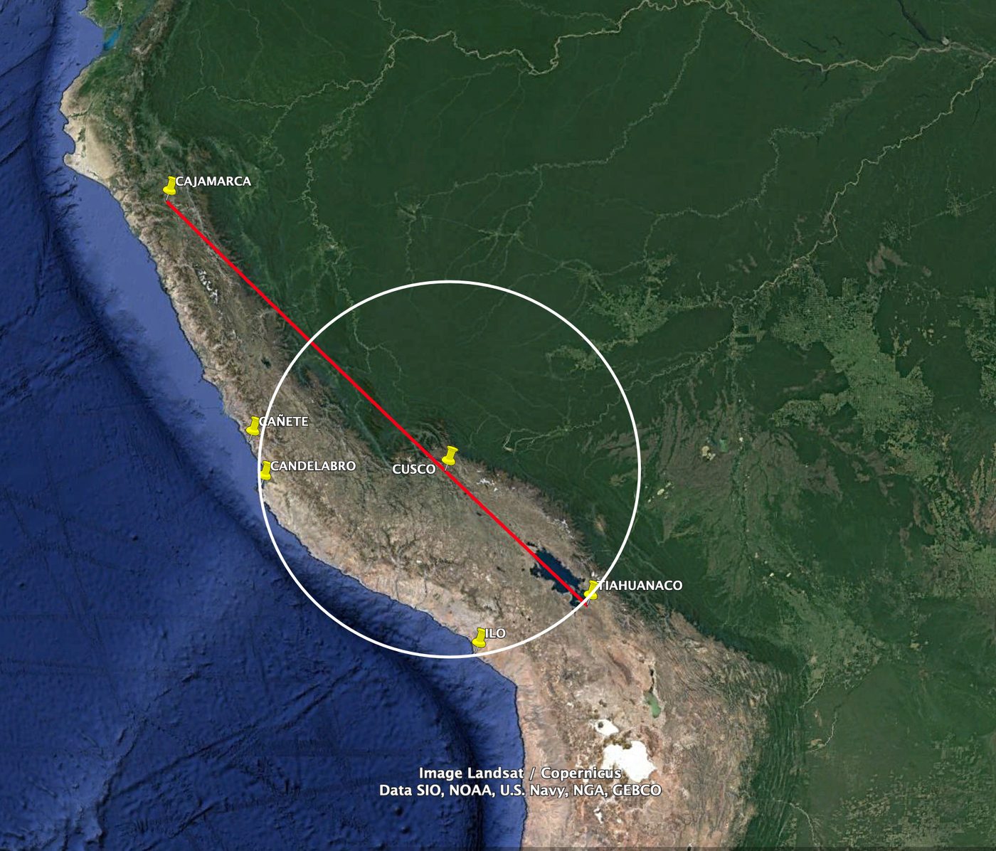
She showed that the places the myths mark as “passage zones” of the teacher god Illa Ticci Wiracocha were aligned and interconnected, forming a great geodesic network. Tiahuanaco, Pukara, Raqchi, Cusco, Ollantaytambo, Machu Picchu and Cajamarca, among others, lie along one and the same alignment at 45° from north. She called this alignment the Route of Wiracocha: what the Andean traditions knew as the Qhapaq Ñan, the Path of the Just, of the Capaccuna, the wise Andean amautas.
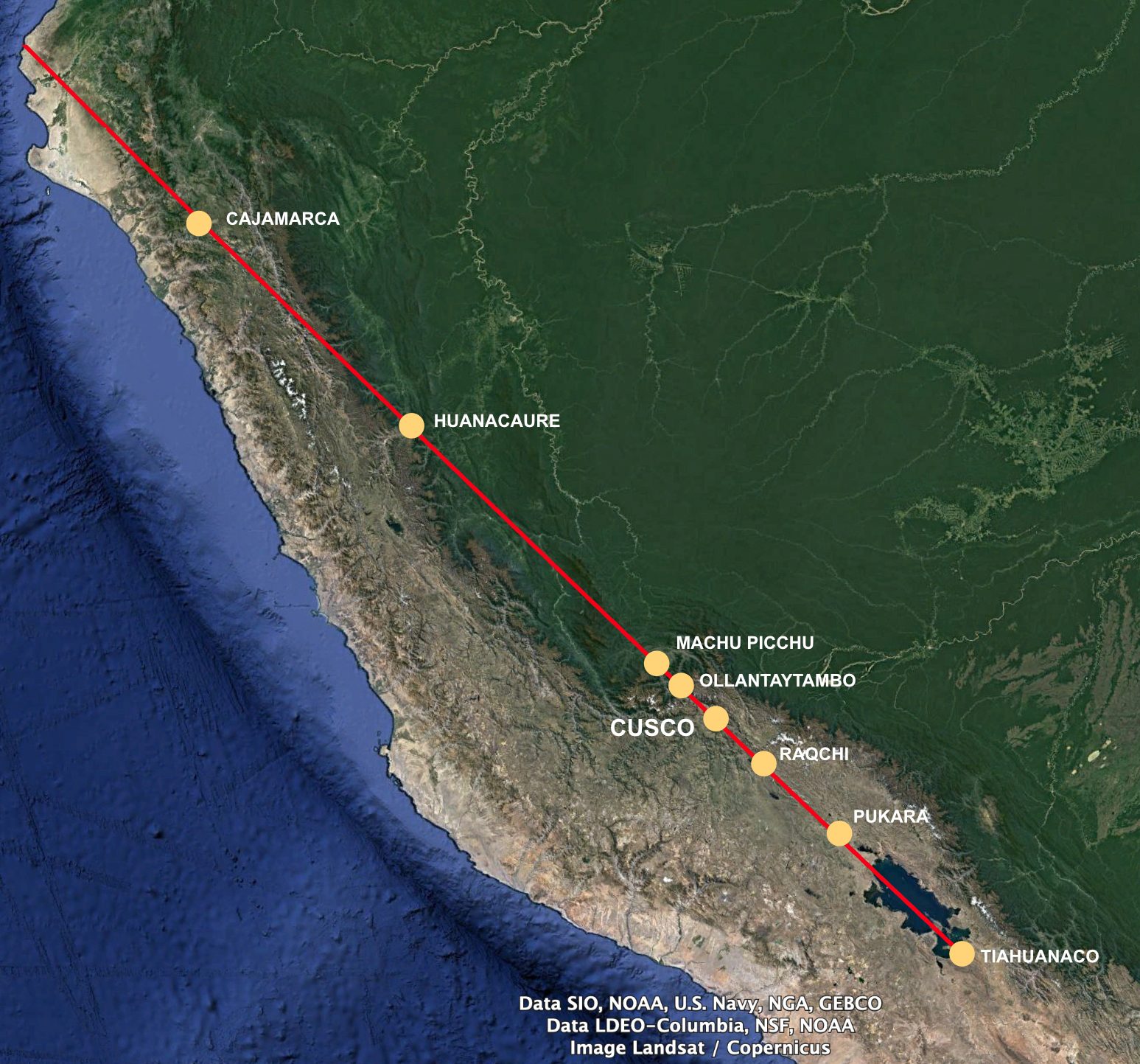
Using modern coordinates, seen from Tiahuanaco, all these sacred centres lie in the same direction, over almost 1,500 kilometres:
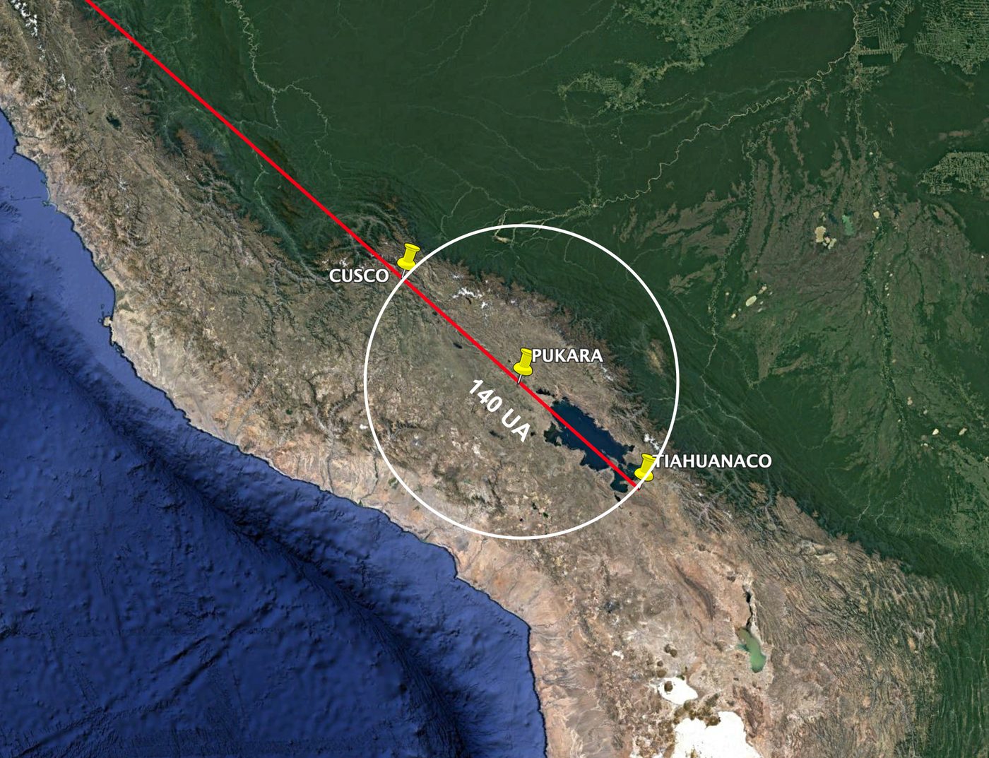
Across all of them, the direction varies by barely a degree and a half. And Pukara lies exactly halfway between Tiahuanaco and Cusco: 247 and 242 kilometres away.
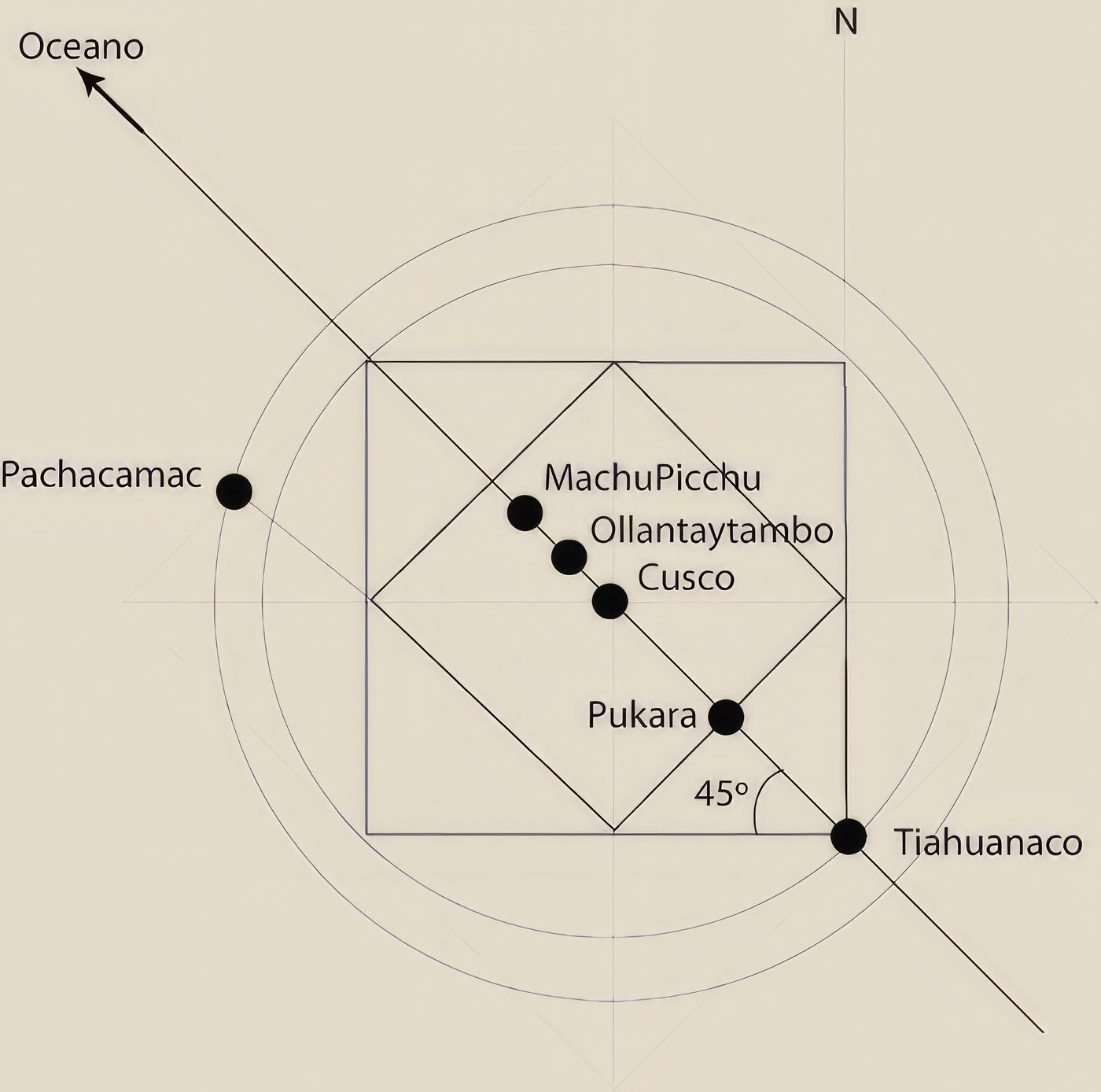
María Scholten drew on the myths the chroniclers preserved. Betanzos tells how Kon Ticci Viracocha, “in the time when this land was all night”, came out of Lake Titicaca, went to Tiahuanaco, sent two messengers, one towards the Contisuyu and the other towards the Antisuyu, and went himself straight to Cusco, and from there to the sea.
Read as geometry, the myth is a plan: the Tiahuanaco–Cusco line, extended to the ocean, forms an angle of 45° with north, and the two messengers, heading southwest and northeast, trace the other diagonal. The myths were not understood because they were encoded through the Art of Memory.
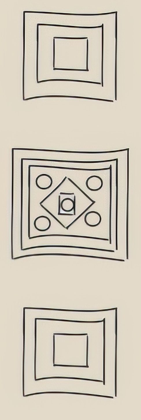
Scholten found the same key in the drawing of the Three Windows by the chronicler Juan de Santa Cruz Pachacuti Yamqui (c. 1613): Maras-Tocco, Tampu-Tocco and Sutic-Tocco were ancient names of key places in the Andes. When she drew the diagonal of the Qhapaq Ñan as the diagonal of a perfect square, combined with other squares and circles, the rest of the places fell into their exact positions.
The Chekkaluwa, the Great Diagonal
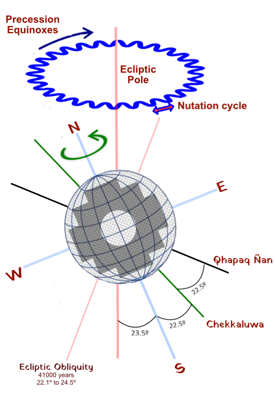
The geometric system of the Andean Cross works with two diagonals. The lesser one, at 45°, operates inside the initial square. The greater one, the Chekkaluwa or Chekka Ñan, is the Great Diagonal: the master beam of existence, the Pachatusan that holds up the world according to Andean tradition.
The Qhapaq Ñan lies at 45° from the planet's north-south axis, and the Great Diagonal at half that angle: 22.5°. It joins and crosses the three vertices of the Chakana, the three Pachas, and contains the value of Pi.
“Diagonal in Quechua is Chekkaluwa, while the word Chekka means Truth. The diagonal, then, could have meant, for the inventors and builders of the great South American geographical system, something like the path of truth.”María Scholten de D'Ebneth · La Ruta de Wirakocha, 1977
We have measured the 22.5° Chekkaluwa at the royal doorway of the Koricancha, in Cusco.
See the measurements in Cusco →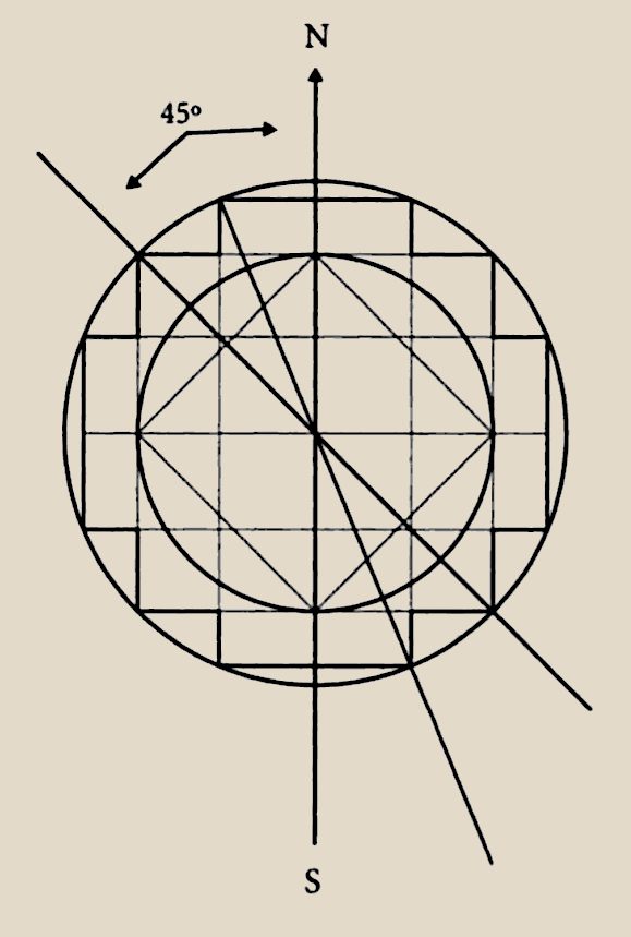
Cusco, centre and axis
If Cusco is the centre and axis of this immense network, why was it founded precisely at that place in the Andes?
María Scholten found the answer in the measure of the Earth. The distance between the Equator and the Tropic of Capricorn, at the time the system was designed, equals 800 American Units. Cusco was founded at 9/16 of that distance: 450 A.U. from the Equator and 350 A.U. from the Tropic. Tiahuanaco, Pukara and Pachacamac fit into the same system of proportions, based on multiples of 7 and 8.
Cusco is thus the synthesis of the Tawantinsuyu, the point where the great axes cross and where the Andean road system keeps its great secret: the Umbilicus Mundi, the Navel of the World.
Cusco, Axis Mundi →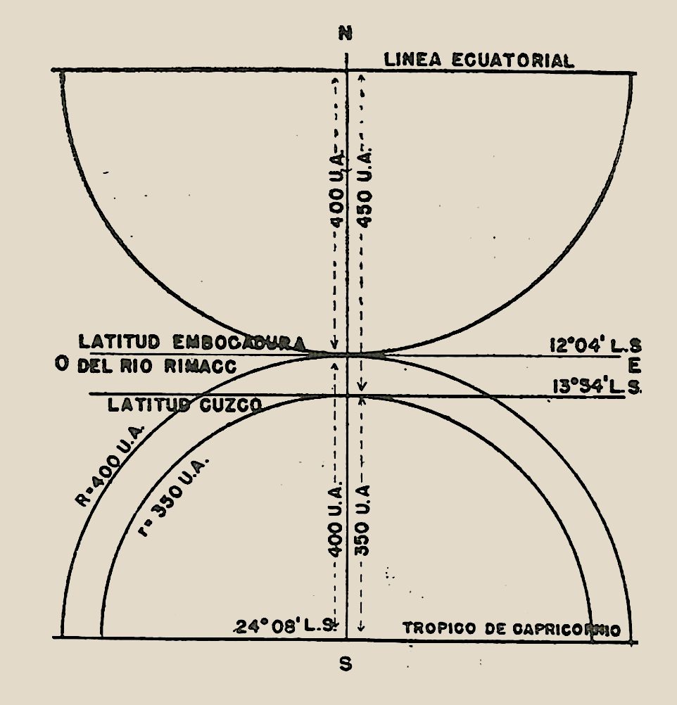
An ancient legacy
The Chakana is an undeniable reality throughout pre-Hispanic America. An age of some 5,500 years has been proposed for the petroglyphs of Queneto (La Libertad), and we find it at Caral, Chavín, Wari, Tiahuanaco, Paracas and Nazca, in textiles, ceramics, paintings and temples all along the mountain range.
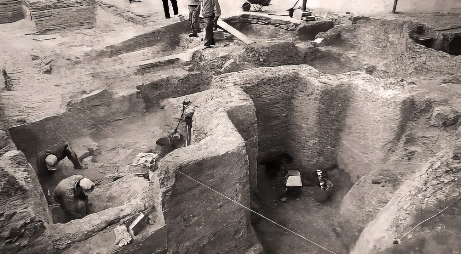
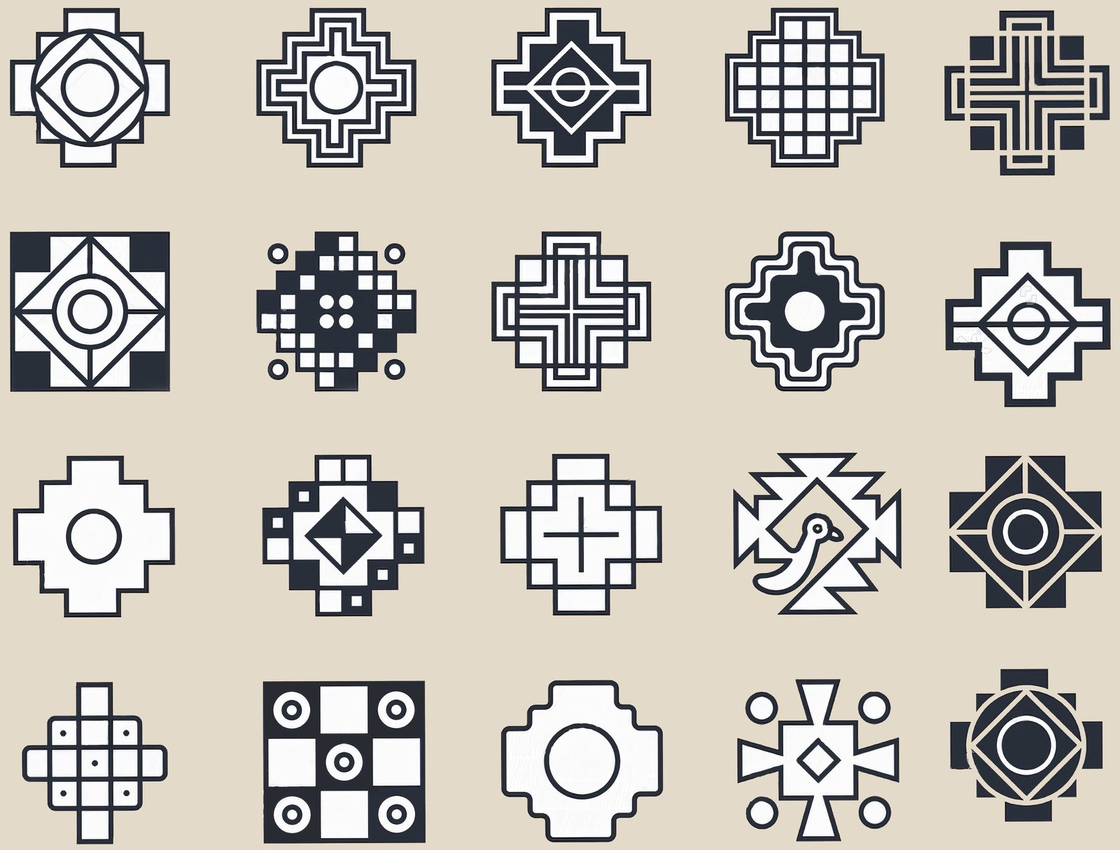
It is no mere coincidence that it is repeated hundreds of thousands of times in the sacred objects of an entire continent. As a bridge and a ladder, the Chakana joins the Cosmos with our planet: the Southern Cross is in the sky in the same measure as the Chakana is on the earth.
Its origin, unknown and preserved by the great Andean amautas, the Capaccuna, raises the decisive questions:
- How was such an immense, complex and sophisticated geodesic network built more than 5,000 years ago, with a technology that no culture of the time possessed?
- Who were its original builders?
- Why did they design it this way, and what was its purpose?
Our answer: the Primordial Mother Culture, the Wiracochas.
Who built it →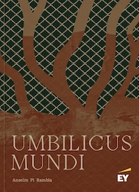
This research is set out in full in chapter 4 of Umbilicus Mundi, “Qhapaq Ñan. The Path of Wisdom”, by Anselm Pi Rambla, with all the maps, drawings and calculations.
See Umbilicus Mundi →