The city of origins
When the Spaniards reached Peru, the Incas told them that Tiwanaku had always been a city in ruins: the city of the first men, created by the god Wiracocha.
Between 2028 and 2029 the Foundation will resume the work it began at Tiwanaku in the 1980s with a new project, the Tiwanaku Project: a ground-penetrating radar survey of the whole archaeological zone —the Akapana, the Kalasasaya, the Gate of the Sun, Pumapunku— followed by an underwater exploration of Lake Titicaca. Always with the authorisation of Bolivia's Ministry of Cultures.
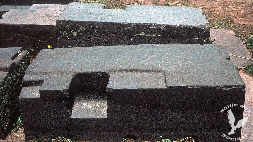
Our work at Tiwanaku
In the 1980s, Anselm Pi Rambla's team filmed the whole archaeological complex of Tiwanaku and then compared the images with the studies of the engineer Arthur Posnansky.
On Lake Titicaca, the team worked on the islands of Taquile and Amantani with their inhabitants and documented their rituals. Later it studied the expedition that Jacques-Yves Cousteau had made to the lake in 1968 with his submarines. It was a work of documentation and study: no ground-penetrating radar surveys or dives in the lake were carried out at that time.
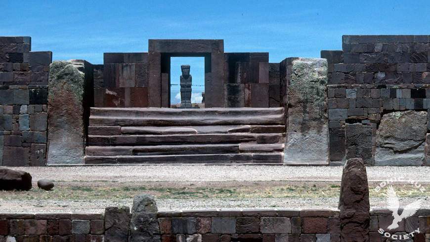
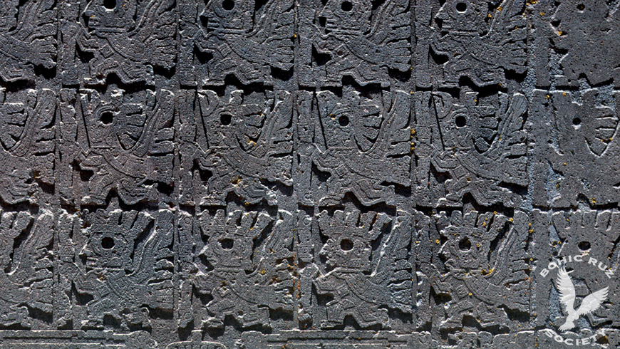
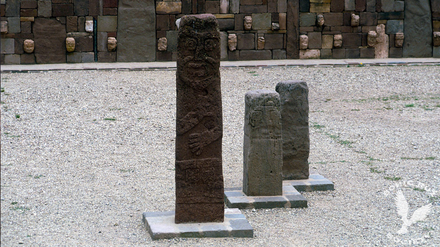
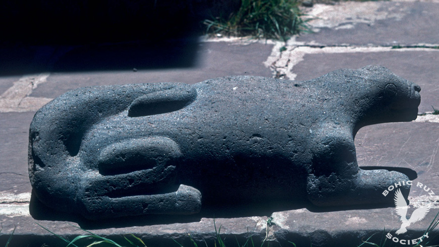
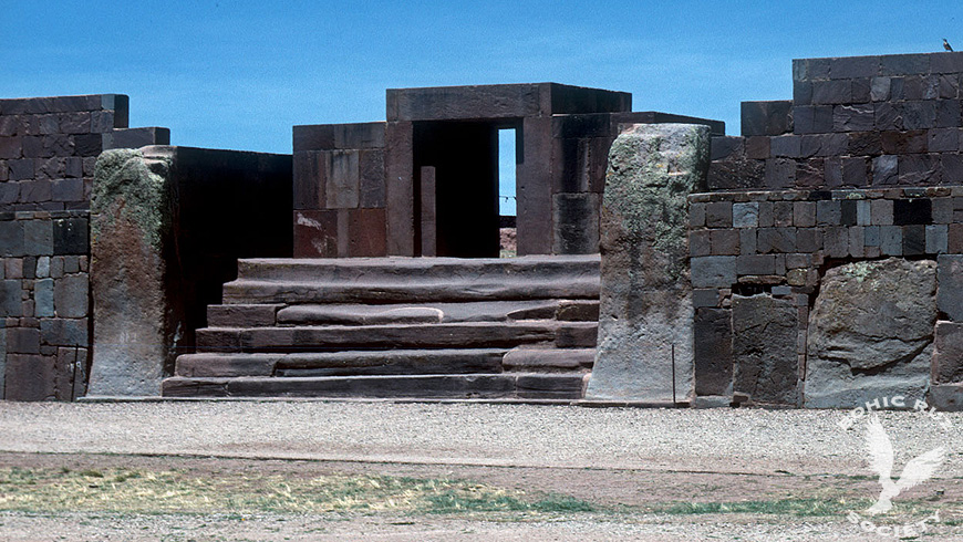
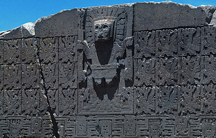
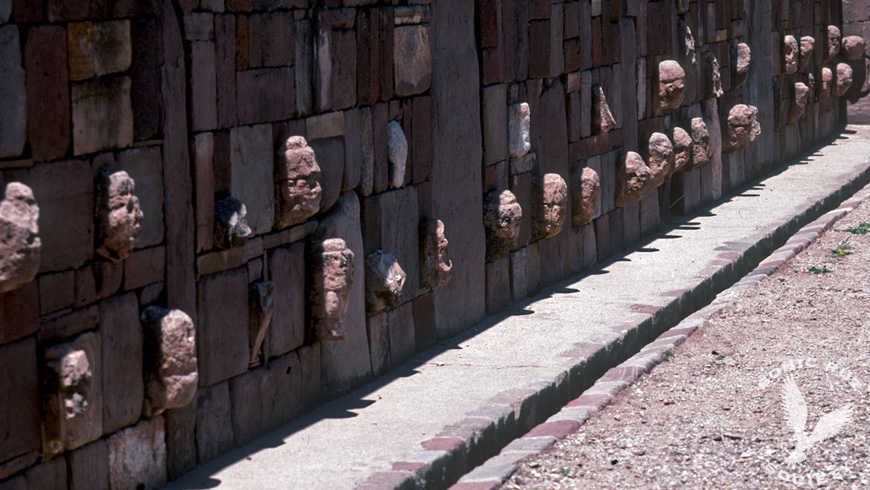
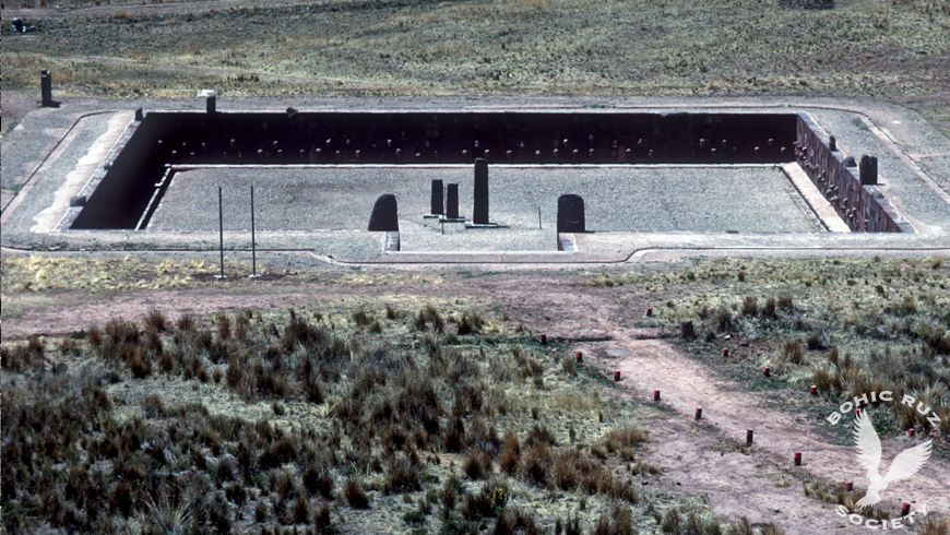
Tiwanaku: the gate of the Kalasasaya, the Gate of the Sun, monoliths of the semi-subterranean temple and a feline sculpture. Photos: Pi Rambla Heritage archive (Bohic Ruz Explorer team, 1980s).
Posnansky and the age of Tiwanaku
At the beginning of the twentieth century, the engineer Arthur Posnansky proposed dating Tiwanaku by the orientation of its monuments. At the Kalasasaya he measured an angle of 23° 8′ 48″, which he interpreted as the obliquity of the ecliptic at the time of its construction, and from it he deduced a date close to 15,000 BC.
According to Posnansky himself, between 1927 and 1930 a group of astronomers —Hans Ludendorff, director of the Potsdam Observatory; Friedrich Becker, of the Vatican Observatory; Arnold Kohlschütter, of the University of Bonn, and Rolf Müller, of the Potsdam Astrophysical Institute— reviewed his measurements and considered that date possible. Posnansky went so far as to link Tiwanaku with Atlantis, and that undermined the credibility of his work.
Today archaeology dates Tiwanaku by radiocarbon: its first monuments, such as the semi-subterranean temple and the Kalasasaya, belong to the first centuries AD; construction of the Akapana began around the seventh century, and the Tiwanaku state developed between the fifth and twelfth centuries. Posnansky's date is considered refuted, but his work remains a reference in Andean archaeoastronomy.
The city below
Some Andean traditions say that the ancient name of Tiwanaku was "Chuchara" and that there were two cities, one above the other: the workers and workshops were above; below was the main city, entered through several galleries.
It is not the only tradition of its kind. In 1877 the American traveller E. George Squier visited Tiwanaku and, describing the Akapana, which he called "the Fortress", recorded this one:
"The tradition runs that there are large vaults filled with treasure beneath the great mound, and that here commences a subterranean passage which leads to Cuzco, more than four hundred miles distant."E. George Squier · Peru: Incidents of Travel and Exploration in the Land of the Incas, 1877, pp. 281-282
About 640 kilometres. Squier adds that the naturalist Johann Jakob von Tschudi found some "caverns" beneath the ruins —it is not clear whether under the Akapana— and tried to go into them, but "was glad to be pulled out, as he soon became suffocated". Squier himself admits that he found no such vaults or passages, "but I do not deny their existence". It is almost the same story that is told of the Chinkana of Cusco.
Without dismissing those traditions, and with the data gathered over years of research, the Foundation puts forward a hypothesis: that between 10 and 25 metres down there could be another, older Tiwanaku. Only a small part of the archaeological zone has been excavated.
Geophysical surveys have already been carried out at Tiwanaku. Between 2002 and 2007 the Pumapunku-Akapana Archaeological Project, directed by Alexei Vranich, combined ground-penetrating radar, magnetometry and other methods, and detected foundations, canals and enclosures near the surface. The Tiwanaku Project wants to look further down.
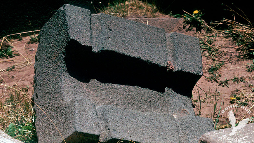
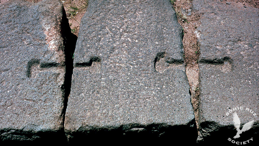
It is a hypothesis, not a result: it is the question the radar will have to answer.
Another hypothesis: artificial stone?
The chemist Joseph Davidovits, founder of geopolymer chemistry, maintains that some blocks of Pumapunku are made of artificial stone, a kind of geopolymer concrete. In Cusco, Trevor Hawke is investigating the same question.
Geopolymers →What Titicaca holds
Lake Titicaca, at 3,812 metres above sea level between Bolivia and Peru, has drawn treasure hunters and seekers of lost cities for decades. There are many accounts:
The American diver William Mardoff, hired to search for a treasure, did not find it, but described "a submerged city of Titans" covered in mud and algae.
The Argentine "Fer de Lance" expedition, led by Ramón Avellaneda, said it had photographed walls of large blocks and paved roads under water.
During the filming of The Sacred Lake, by Hugo Boero Rojo, the team spoke of "Cyclopean embankments similar to the fortress of Sacsayhuamán". On 4 December 1980, the La Paz press published statements by divers describing monumental stone blocks and roads that disappeared into the depths.
These accounts have not been confirmed by published scientific studies.
In 1968 Jacques-Yves Cousteau went down into the lake with his submarines in search of sunken cities. He found no ruins, but he filmed the giant Titicaca frog at a depth of 120 metres.
Scientific underwater archaeology came later. In 2013 the team of Christophe Delaere (Université Libre de Bruxelles and University of Oxford) excavated the Khoa reef, next to the Island of the Sun, at a depth of 5 to 7 metres, using sonar, 3D photogrammetry and stratigraphic excavation. It found ritual offerings from the Tiwanaku period, dated between AD 794 and 964: puma-shaped ceramic incense burners, sacrificed young llamas, gold pieces bearing the face of the Tiwanaku deity, fine stones and Spondylus shells brought from the coast of Ecuador, some 2,000 kilometres away. Stone anchors show that the offerings were thrown from boats. The results were published in 2019 in the journal PNAS.
They are not sunken cities, but offerings on a sacred reef. Yet they confirm that the lake was a sacred centre centuries before the Incas, and their method —sonar, photogrammetry, stratigraphic excavation and dating— is the one the underwater phase of the Tiwanaku Project will follow.
What we want to find out
The Tiwanaku Project will take place between 2028 and 2029. It is a research plan, always with the authorisation of Bolivia's Ministry of Cultures:
1. Radar over the archaeological zone
A 3D ground-penetrating radar survey of the Akapana, the Kalasasaya, the Gate of the Sun, the semi-subterranean temple and Pumapunku, to look for structures buried deeper than in previous studies.
2. Compare with what is already known
Check the results against our filming from the 1980s, Posnansky's measurements and the geophysical surveys already published.
3. Lake Titicaca
In a second phase, an underwater exploration of the lake, with sonar and photogrammetry, continuing the work done so far.